Gurtweil nach Laufenburg u. zurück
A cycling route starting in Weilheim, Baden-Württemberg, Germany.
Overview
About this route
Meist flach und asphaltiert. Ca. 3km auf Schweizer Nationalstraße 7 von Schwaderloch westwärts nur eingezeichnete Radspur, sonst abseits der stark befahrenen Autostraßen.
Schöne Städte: Waldshut und Laufenburg
- -:--
- Duration
- 47.9 km
- Distance
- 210 m
- Ascent
- 212 m
- Descent
- ---
- Avg. speed
- ---
- Avg. speed
Route quality
Waytypes & surfaces along the route
Waytypes
Quiet road
19.1 km
(40 %)
Track
10.1 km
(21 %)
Surfaces
Paved
29.8 km
(62 %)
Unpaved
5.8 km
(12 %)
Asphalt
26.1 km
(54 %)
Gravel
5 km
(10 %)
Continue with Bikemap
Use, edit, or download this cycling route
You would like to ride Gurtweil nach Laufenburg u. zurück or customize it for your own trip? Here is what you can do with this Bikemap route:
Free features
- Save this route as favorite or in collections
- Copy & plan your own version of this route
- Sync your route with Garmin or Wahoo
Premium features
Free trial for 3 days, or one-time payment. More about Bikemap Premium.
- Navigate this route on iOS & Android
- Export a GPX / KML file of this route
- Create your custom printout (try it for free)
- Download this route for offline navigation
Discover more Premium features.
Get Bikemap PremiumFrom our community
Other popular routes starting in Weilheim
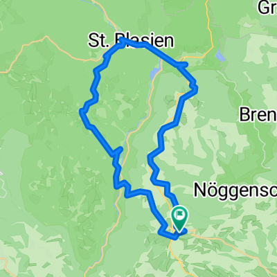
- Tiengen - Schluchsee - Bonndorf - Tiengen
- Distance
- 69.8 km
- Ascent
- 921 m
- Descent
- 907 m
- Location
- Weilheim, Baden-Württemberg, Germany
- Feldberg
- Distance
- 108.6 km
- Ascent
- 1,317 m
- Descent
- 1,352 m
- Location
- Weilheim, Baden-Württemberg, Germany
- Gurtweil über Koblenz/CH - Kaierstuhl/CH - Hohentengen Küssaberg und zurück und zu
- Distance
- 46.6 km
- Ascent
- 217 m
- Descent
- 218 m
- Location
- Weilheim, Baden-Württemberg, Germany
- Fohrenbachtal
- Distance
- 28.5 km
- Ascent
- 635 m
- Descent
- 653 m
- Location
- Weilheim, Baden-Württemberg, Germany
- Tiengen-Schluchsee
- Distance
- 32.2 km
- Ascent
- 1,037 m
- Descent
- 803 m
- Location
- Weilheim, Baden-Württemberg, Germany
- Gurtweil nach Laufenburg u. zurück
- Distance
- 47.9 km
- Ascent
- 210 m
- Descent
- 212 m
- Location
- Weilheim, Baden-Württemberg, Germany
- Nöggenschwiel-Schadenbirndorf
- Distance
- 31.9 km
- Ascent
- 595 m
- Descent
- 592 m
- Location
- Weilheim, Baden-Württemberg, Germany
- Radroute Mettmatal, Schluchsee, Hausern Nöggenschwiel
- Distance
- 62.3 km
- Ascent
- 757 m
- Descent
- 757 m
- Location
- Weilheim, Baden-Württemberg, Germany
Open it in the app