

Родниковая улица, Во́лжский район до 36Н-590, Жигулевск
A cycling route starting in Rozhdestveno, Samara Oblast, Russia.
Overview
About this route
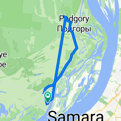
The route starts in Shiryaevo. The ride begins on an asphalt road to the left of the pier; after 200-300 meters, you'll see a memorial on the right, near which you should turn right onto a dirt road. The road passes through the village so that the main part of the village and the lakes remain on the left, and the hill with the adits is on the right. After a couple of kilometers, the village ends, and your path runs through the picturesque, gradually narrowing Shiryaevsky ravine. The road here is a well-worn dirt track frequently used by cars heading to the Stone Cup. About 10 km from the Shiryaevo pier, you'll reach the Stone Cup, where there is a signpost. On weekends, many cars and people gather near the spring, so you might not get spring water. If there are few people, you can bathe in the bathing hut. It’s better to stock up on water earlier, in Shiryaevo. After the Cup, the road worsens, becoming more overgrown. For 2-3 km after the Cup, the Shiryaevsky ravine is at its narrowest, the road is rocky and may be muddy if it has rained recently. On the left side of the road, you’ll see small grottoes in the rock.
Gradually the ravine widens again, and the road cheerfully winds over small hills. About 12 km from the Cup, you'll see far ahead a power line crossing the ravine diagonally. About 1-1.5 km before it, look for a sharp left turn climbing the hill. If you miss it, go to the power line and climb the left slope of the ravine just below it.
Now, for about 5 km, the road follows a forest clearing under the power lines, then leads out to a field. Before exiting onto the field, on the right side of the road, you'll find a comfortable resting place — a table and chairs made from tree stumps. The field road, after a long descent, leads to Tornovoye, from where there are 8 km of asphalt left to Rozhdestveno.
- 3 h 46 min
- Duration
- 41.5 km
- Distance
- 0 m
- Ascent
- 0 m
- Descent
- 11 km/h
- Avg. speed
- 0 m
- Max. altitude
Route quality
Waytypes & surfaces along the route
Waytypes
Track
28.7 km
(69 %)
Road
7.5 km
(18 %)
Surfaces
Paved
11.2 km
(27 %)
Unpaved
26.2 km
(63 %)
Ground
26.2 km
(63 %)
Asphalt
11.2 km
(27 %)
Undefined
4.2 km
(10 %)
Continue with Bikemap
Use, edit, or download this cycling route
You would like to ride Родниковая улица, Во́лжский район до 36Н-590, Жигулевск or customize it for your own trip? Here is what you can do with this Bikemap route:
Free features
- Save this route as favorite or in collections
- Copy & plan your own version of this route
- Sync your route with Garmin or Wahoo
Premium features
Free trial for 3 days, or one-time payment. More about Bikemap Premium.
- Navigate this route on iOS & Android
- Export a GPX / KML file of this route
- Create your custom printout (try it for free)
- Download this route for offline navigation
Discover more Premium features.
Get Bikemap PremiumFrom our community
Other popular routes starting in Rozhdestveno
 Рождествено
- Distance
- 12 km
- Ascent
- 55 m
- Descent
- 56 m
- Location
- Rozhdestveno, Samara Oblast, Russia
 Рождество-Торновое-Каменная чаша-Ширяево
- Distance
- 44.7 km
- Ascent
- 1,317 m
- Descent
- 1,318 m
- Location
- Rozhdestveno, Samara Oblast, Russia
 Рождество Жиг море
- Distance
- 85.1 km
- Ascent
- 795 m
- Descent
- 770 m
- Location
- Rozhdestveno, Samara Oblast, Russia
 Восстановительный маршрут
- Distance
- 25.1 km
- Ascent
- 85 m
- Descent
- 94 m
- Location
- Rozhdestveno, Samara Oblast, Russia
 Трындец полный, зато красиво по пути
- Distance
- 137 km
- Ascent
- 3,534 m
- Descent
- 3,528 m
- Location
- Rozhdestveno, Samara Oblast, Russia
 Родниковая улица, Во́лжский район до 36Н-590, Жигулевск
- Distance
- 41.5 km
- Ascent
- 0 m
- Descent
- 0 m
- Location
- Rozhdestveno, Samara Oblast, Russia
 Restful route in Samara (Rozhdestveno - Podgory)
- Distance
- 25.5 km
- Ascent
- 52 m
- Descent
- 94 m
- Location
- Rozhdestveno, Samara Oblast, Russia
 ПВД разминка
- Distance
- 9.7 km
- Ascent
- 63 m
- Descent
- 68 m
- Location
- Rozhdestveno, Samara Oblast, Russia
Open it in the app