

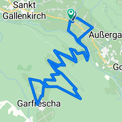
St. Gallenkirch - Silvretta Stausee
A cycling route starting in Sankt Gallenkirch, Vorarlberg, Austria.
Overview
About this route
Cool accommodation is Base-Montafon in St. Gallenkirch!!!
- -:--
- Duration
- 51.8 km
- Distance
- 1,356 m
- Ascent
- 1,356 m
- Descent
- ---
- Avg. speed
- ---
- Max. altitude
Route quality
Waytypes & surfaces along the route
Waytypes
Quiet road
7.2 km
(14 %)
Track
6.7 km
(13 %)
Surfaces
Paved
50.2 km
(97 %)
Unpaved
1 km
(2 %)
Asphalt
50.2 km
(97 %)
Gravel
1 km
(2 %)
Undefined
0.5 km
(1 %)
Continue with Bikemap
Use, edit, or download this cycling route
You would like to ride St. Gallenkirch - Silvretta Stausee or customize it for your own trip? Here is what you can do with this Bikemap route:
Free features
- Save this route as favorite or in collections
- Copy & plan your own version of this route
- Sync your route with Garmin or Wahoo
Premium features
Free trial for 3 days, or one-time payment. More about Bikemap Premium.
- Navigate this route on iOS & Android
- Export a GPX / KML file of this route
- Create your custom printout (try it for free)
- Download this route for offline navigation
Discover more Premium features.
Get Bikemap PremiumFrom our community
Other popular routes starting in Sankt Gallenkirch
 Rund um die Valisera Talstation
- Distance
- 0.7 km
- Ascent
- 4 m
- Descent
- 0 m
- Location
- Sankt Gallenkirch, Vorarlberg, Austria
 St Galllenkirch test2
- Distance
- 11 km
- Ascent
- 1,324 m
- Descent
- 36 m
- Location
- Sankt Gallenkirch, Vorarlberg, Austria
 Oesterreich
- Distance
- 57.5 km
- Ascent
- 1,912 m
- Descent
- 1,913 m
- Location
- Sankt Gallenkirch, Vorarlberg, Austria
 Bartholomäberg
- Distance
- 35.5 km
- Ascent
- 763 m
- Descent
- 755 m
- Location
- Sankt Gallenkirch, Vorarlberg, Austria
 von Galgenul ueber das Schlappinerjoch nach Klosters
- Distance
- 18.4 km
- Ascent
- 1,414 m
- Descent
- 1,124 m
- Location
- Sankt Gallenkirch, Vorarlberg, Austria
 St. Gallenkirch - Silvretta Stausee
- Distance
- 51.8 km
- Ascent
- 1,356 m
- Descent
- 1,356 m
- Location
- Sankt Gallenkirch, Vorarlberg, Austria
 2023_RR_Silvretta_Zeinisjoch
- Distance
- 70.4 km
- Ascent
- 2,098 m
- Descent
- 2,096 m
- Location
- Sankt Gallenkirch, Vorarlberg, Austria
 Nach Garfecha
- Distance
- 10.8 km
- Ascent
- 670 m
- Descent
- 667 m
- Location
- Sankt Gallenkirch, Vorarlberg, Austria
Open it in the app