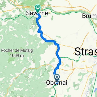
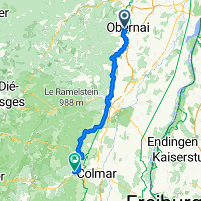
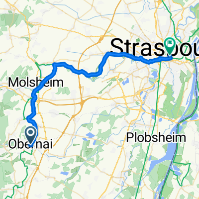
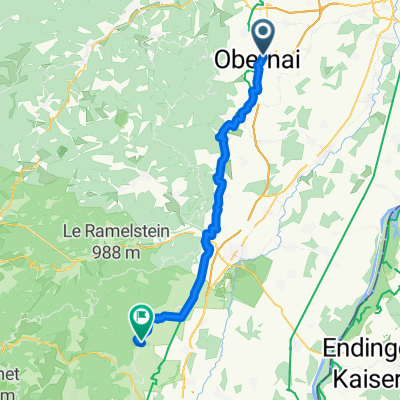
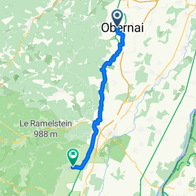
vtt 1
A cycling route starting in Obernai, Alsace-Champagne-Ardenne-Lorraine, France.
Overview
About this route
- 1 h 30 min
- Duration
- 22.5 km
- Distance
- 750 m
- Ascent
- 751 m
- Descent
- 15 km/h
- Avg. speed
- 764 m
- Avg. speed
Route quality
Waytypes & surfaces along the route
Waytypes
Track
6.5 km
(29 %)
Quiet road
5 km
(22 %)
Surfaces
Paved
6.6 km
(30 %)
Unpaved
4.8 km
(22 %)
Asphalt
6.2 km
(27 %)
Gravel
3.3 km
(15 %)
Continue with Bikemap
Use, edit, or download this cycling route
You would like to ride vtt 1 or customize it for your own trip? Here is what you can do with this Bikemap route:
Free features
- Save this route as favorite or in collections
- Copy & plan your own version of this route
- Sync your route with Garmin or Wahoo
Premium features
Free trial for 3 days, or one-time payment. More about Bikemap Premium.
- Navigate this route on iOS & Android
- Export a GPX / KML file of this route
- Create your custom printout (try it for free)
- Download this route for offline navigation
Discover more Premium features.
Get Bikemap PremiumFrom our community
Other popular routes starting in Obernai
- vtt 1
- Distance
- 22.5 km
- Ascent
- 750 m
- Descent
- 751 m
- Location
- Obernai, Alsace-Champagne-Ardenne-Lorraine, France
- Deutschland - Portugal (Berlin - Faro) FR 05 Obernai - Colmar
- Distance
- 55.4 km
- Ascent
- 327 m
- Descent
- 290 m
- Location
- Obernai, Alsace-Champagne-Ardenne-Lorraine, France
- Obernai - Strasbourg
- Distance
- 37 km
- Ascent
- 123 m
- Descent
- 160 m
- Location
- Obernai, Alsace-Champagne-Ardenne-Lorraine, France
- Obernai – Mittelbergheim - Dambach La – Ville - Obernai
- Distance
- 57.9 km
- Ascent
- 244 m
- Descent
- 239 m
- Location
- Obernai, Alsace-Champagne-Ardenne-Lorraine, France
- Runde um Obernai
- Distance
- 30 km
- Ascent
- 176 m
- Descent
- 178 m
- Location
- Obernai, Alsace-Champagne-Ardenne-Lorraine, France
- Etappe 2 - Obernai-Molsheim-Dompeterbruche-Krautergersheim
- Distance
- 43 km
- Ascent
- 124 m
- Descent
- 126 m
- Location
- Obernai, Alsace-Champagne-Ardenne-Lorraine, France
- BTR : départ
- Distance
- 14.9 km
- Ascent
- 618 m
- Descent
- 47 m
- Location
- Obernai, Alsace-Champagne-Ardenne-Lorraine, France
- Obernai Riquwihr
- Distance
- 47 km
- Ascent
- 495 m
- Descent
- 372 m
- Location
- Obernai, Alsace-Champagne-Ardenne-Lorraine, France
Open it in the app