

중앙로, 대전광역시에서 용산동, 대전광역시까지
A cycling route starting in Daejeon, Daejeon, South Korea.
Overview
About this route
- 55 min
- Duration
- 14.2 km
- Distance
- 211 m
- Ascent
- 257 m
- Descent
- 15.5 km/h
- Avg. speed
- 102 m
- Max. altitude
Continue with Bikemap
Use, edit, or download this cycling route
You would like to ride 중앙로, 대전광역시에서 용산동, 대전광역시까지 or customize it for your own trip? Here is what you can do with this Bikemap route:
Free features
- Save this route as favorite or in collections
- Copy & plan your own version of this route
- Sync your route with Garmin or Wahoo
Premium features
Free trial for 3 days, or one-time payment. More about Bikemap Premium.
- Navigate this route on iOS & Android
- Export a GPX / KML file of this route
- Create your custom printout (try it for free)
- Download this route for offline navigation
Discover more Premium features.
Get Bikemap PremiumFrom our community
Other popular routes starting in Daejeon
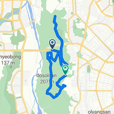 도솔산 싱글
- Distance
- 11.7 km
- Ascent
- 485 m
- Descent
- 459 m
- Location
- Daejeon, Daejeon, South Korea
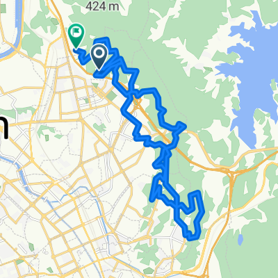
![대한민국Ph0]으로 라우팅](https://www.bikemap.net/media/temp/routes_gallery/ae35e3c8-353b-403b-b2ed-7bd7249ddc20.jpg) 대한민국Ph0]으로 라우팅
대한민국Ph0]으로 라우팅- Distance
- 64 km
- Ascent
- 242 m
- Descent
- 306 m
- Location
- Daejeon, Daejeon, South Korea
 계족산 비룡동 20250831
- Distance
- 27.1 km
- Ascent
- 936 m
- Descent
- 922 m
- Location
- Daejeon, Daejeon, South Korea
 편안한 경로
- Distance
- 21.4 km
- Ascent
- 52 m
- Descent
- 83 m
- Location
- Daejeon, Daejeon, South Korea
 안정적인 라이딩
- Distance
- 14.6 km
- Ascent
- 19 m
- Descent
- 37 m
- Location
- Daejeon, Daejeon, South Korea
 옥계동 170−36 to 미호동 53−9
- Distance
- 33.5 km
- Ascent
- 278 m
- Descent
- 291 m
- Location
- Daejeon, Daejeon, South Korea
 뿌리공원 02
- Distance
- 39.3 km
- Ascent
- 218 m
- Descent
- 265 m
- Location
- Daejeon, Daejeon, South Korea
 판암역 대청호 유성집
- Distance
- 35.7 km
- Ascent
- 422 m
- Descent
- 479 m
- Location
- Daejeon, Daejeon, South Korea
Open it in the app