

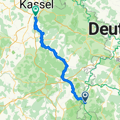
Von Geisa bis Hofbieber
A cycling route starting in Geisa, Thuringia, Germany.
Overview
About this route
- 2 h 14 min
- Duration
- 32.9 km
- Distance
- 686 m
- Ascent
- 187 m
- Descent
- 14.7 km/h
- Avg. speed
- 802 m
- Max. altitude

Route quality
Waytypes & surfaces along the route
Waytypes
Track
8.2 km
(25 %)
Cycleway
7.9 km
(24 %)
Surfaces
Paved
27.6 km
(84 %)
Unpaved
4.3 km
(13 %)
Asphalt
26.6 km
(81 %)
Gravel
2.3 km
(7 %)
Continue with Bikemap
Use, edit, or download this cycling route
You would like to ride Von Geisa bis Hofbieber or customize it for your own trip? Here is what you can do with this Bikemap route:
Free features
- Save this route as favorite or in collections
- Copy & plan your own version of this route
- Sync your route with Garmin or Wahoo
Premium features
Free trial for 3 days, or one-time payment. More about Bikemap Premium.
- Navigate this route on iOS & Android
- Export a GPX / KML file of this route
- Create your custom printout (try it for free)
- Download this route for offline navigation
Discover more Premium features.
Get Bikemap PremiumFrom our community
Other popular routes starting in Geisa
 Geisa - Eisenach
- Distance
- 70.8 km
- Ascent
- 234 m
- Descent
- 300 m
- Location
- Geisa, Thuringia, Germany
 Rhöntour
- Distance
- 47.7 km
- Ascent
- 877 m
- Descent
- 877 m
- Location
- Geisa, Thuringia, Germany
 Geisa nach Hof
- Distance
- 316.7 km
- Ascent
- 4,675 m
- Descent
- 4,485 m
- Location
- Geisa, Thuringia, Germany
 Tag 2
Tag 2- Distance
- 20.1 km
- Ascent
- 486 m
- Descent
- 485 m
- Location
- Geisa, Thuringia, Germany
 Von Geisa bis Hofbieber
- Distance
- 32.9 km
- Ascent
- 686 m
- Descent
- 187 m
- Location
- Geisa, Thuringia, Germany
 Geisa-Hünfeld
- Distance
- 21.3 km
- Ascent
- 211 m
- Descent
- 266 m
- Location
- Geisa, Thuringia, Germany
 BR-Kanz-Lämm-BR
- Distance
- 23.9 km
- Ascent
- 563 m
- Descent
- 565 m
- Location
- Geisa, Thuringia, Germany
 D8: Geisa - Fuldabrück
- Distance
- 102.8 km
- Ascent
- 748 m
- Descent
- 848 m
- Location
- Geisa, Thuringia, Germany
Open it in the app