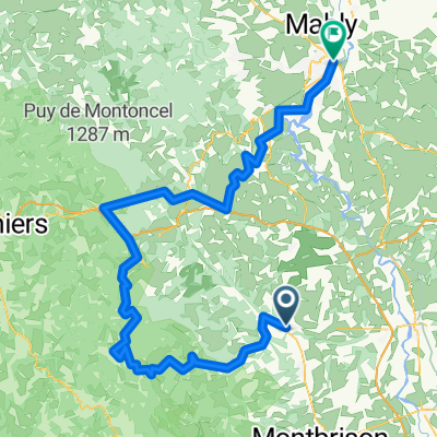
Route nach Lyon
A cycling route starting in Bo毛n-sur-Lignon, Auvergne-Rh么ne-Alpes, France.
Overview
About this route
- 5 h 40 min
- Duration
- 92.8 km
- Distance
- 1,350 m
- Ascent
- 1,577 m
- Descent
- 16.4 km/h
- Avg. speed
- 748 m
- Avg. speed
Route quality
Waytypes & surfaces along the route
Waytypes
Quiet road
55.3 km
(60 %)
Road
13.8 km
(15 %)
Surfaces
Paved
33.1 km
(36 %)
Unpaved
3.3 km
(4 %)
Asphalt
33 km
(36 %)
Ground
1.8 km
(2 %)
Continue with Bikemap
Use, edit, or download this cycling route
You would like to ride Route nach Lyon or customize it for your own trip? Here is what you can do with this Bikemap route:
Free features
- Save this route as favorite or in collections
- Copy & plan your own version of this route
- Sync your route with Garmin or Wahoo
Premium features
Free trial for 3 days, or one-time payment. More about Bikemap Premium.
- Navigate this route on iOS & Android
- Export a GPX / KML file of this route
- Create your custom printout (try it for free)
- Download this route for offline navigation
Discover more Premium features.
Get Bikemap PremiumFrom our community
Other popular routes starting in Bo毛n-sur-Lignon
- 10. Hurongues to Boen Sur Ligon
- Distance
- 47.9 km
- Ascent
- 352 m
- Descent
- 191 m
- Location
- Bo毛n-sur-Lignon, Auvergne-Rh么ne-Alpes, France
- C053-Montverdun-Montbrison
- Distance
- 17.1 km
- Ascent
- 361 m
- Descent
- 345 m
- Location
- Bo毛n-sur-Lignon, Auvergne-Rh么ne-Alpes, France
- 11. Boen Sur Ligon to Thiers
- Distance
- 62.9 km
- Ascent
- 774 m
- Descent
- 873 m
- Location
- Bo毛n-sur-Lignon, Auvergne-Rh么ne-Alpes, France
- Duphine 3陋
- Distance
- 184.3 km
- Ascent
- 1,528 m
- Descent
- 1,803 m
- Location
- Bo毛n-sur-Lignon, Auvergne-Rh么ne-Alpes, France
- De La Varenne, Saint-脡tienne-le-Molard 脿 La Varenne, Saint-脡tienne-le-Molard
- Distance
- 13.4 km
- Ascent
- 104 m
- Descent
- 98 m
- Location
- Bo毛n-sur-Lignon, Auvergne-Rh么ne-Alpes, France
- Route nach Lyon
- Distance
- 92.8 km
- Ascent
- 1,350 m
- Descent
- 1,577 m
- Location
- Bo毛n-sur-Lignon, Auvergne-Rh么ne-Alpes, France
- Haut Forez
- Distance
- 141.3 km
- Ascent
- 2,151 m
- Descent
- 2,151 m
- Location
- Bo毛n-sur-Lignon, Auvergne-Rh么ne-Alpes, France
- De 355 Route de la Grande Grange, Saint-Etienne-le-Molard 脿 349 Route de la Grande Grange, Saint-Etienne-le-Molard
- Distance
- 17.8 km
- Ascent
- 92 m
- Descent
- 92 m
- Location
- Bo毛n-sur-Lignon, Auvergne-Rh么ne-Alpes, France
Open it in the app