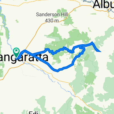
Untitled route
A cycling route starting in Wangaratta, Victoria, Australia.
Overview
About this route
- 14 h 43 min
- Duration
- 257.3 km
- Distance
- 1,873 m
- Ascent
- 1,875 m
- Descent
- 17.5 km/h
- Avg. speed
- 608 m
- Max. altitude
Route quality
Waytypes & surfaces along the route
Waytypes
Cycleway
210.4 km
(82 %)
Road
28.9 km
(11 %)
Surfaces
Paved
209.6 km
(81 %)
Unpaved
14.1 km
(5 %)
Asphalt
110.4 km
(43 %)
Paved (undefined)
98.6 km
(38 %)
Continue with Bikemap
Use, edit, or download this cycling route
You would like to ride Untitled route or customize it for your own trip? Here is what you can do with this Bikemap route:
Free features
- Save this route as favorite or in collections
- Copy & plan your own version of this route
- Split it into stages to create a multi-day tour
- Sync your route with Garmin or Wahoo
Premium features
Free trial for 3 days, or one-time payment. More about Bikemap Premium.
- Navigate this route on iOS & Android
- Export a GPX / KML file of this route
- Create your custom printout (try it for free)
- Download this route for offline navigation
Discover more Premium features.
Get Bikemap PremiumFrom our community
Other popular routes starting in Wangaratta
- Wangaratta to Myrtleford-alt
- Distance
- 54.7 km
- Ascent
- 251 m
- Descent
- 190 m
- Location
- Wangaratta, Victoria, Australia
- Wangaratta Loop
- Distance
- 52.9 km
- Ascent
- 379 m
- Descent
- 382 m
- Location
- Wangaratta, Victoria, Australia
- Wangaratta to Albury
- Distance
- 112.9 km
- Ascent
- 1,057 m
- Descent
- 1,050 m
- Location
- Wangaratta, Victoria, Australia
- milawa loop
- Distance
- 23.5 km
- Ascent
- 22 m
- Descent
- 22 m
- Location
- Wangaratta, Victoria, Australia
- Untitled route
- Distance
- 257.3 km
- Ascent
- 1,873 m
- Descent
- 1,875 m
- Location
- Wangaratta, Victoria, Australia
- Herald Sun Tour 2017 Stage 1
- Distance
- 178.9 km
- Ascent
- 2,096 m
- Descent
- 699 m
- Location
- Wangaratta, Victoria, Australia
- Eva Street 1, Wangaratta to Eva Street 1, Wangaratta
- Distance
- 12.8 km
- Ascent
- 14 m
- Descent
- 15 m
- Location
- Wangaratta, Victoria, Australia
- Wangaratta-Myrtleford-Bright rail trail
- Distance
- 83.3 km
- Ascent
- 354 m
- Descent
- 184 m
- Location
- Wangaratta, Victoria, Australia
Open it in the app