

Weidenweg, Cologne to Quintinsstraße, Mainz
A cycling route starting in Poll, North Rhine-Westphalia, Germany.
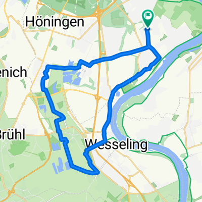
Overview
About this route
- 12 h 1 min
- Duration
- 193.2 km
- Distance
- 1,380 m
- Ascent
- 1,328 m
- Descent
- 16.1 km/h
- Avg. speed
- 128 m
- Max. altitude
Route quality
Waytypes & surfaces along the route
Waytypes
Path
99.4 km
(51 %)
Quiet road
34.1 km
(18 %)
Surfaces
Paved
183.6 km
(95 %)
Unpaved
3.9 km
(2 %)
Asphalt
148.5 km
(77 %)
Paving stones
30.9 km
(16 %)
Continue with Bikemap
Use, edit, or download this cycling route
You would like to ride Weidenweg, Cologne to Quintinsstraße, Mainz or customize it for your own trip? Here is what you can do with this Bikemap route:
Free features
- Save this route as favorite or in collections
- Copy & plan your own version of this route
- Split it into stages to create a multi-day tour
- Sync your route with Garmin or Wahoo
Premium features
Free trial for 3 days, or one-time payment. More about Bikemap Premium.
- Navigate this route on iOS & Android
- Export a GPX / KML file of this route
- Create your custom printout (try it for free)
- Download this route for offline navigation
Discover more Premium features.
Get Bikemap PremiumFrom our community
Other popular routes starting in Poll
 Poll-Hohkeppel-Altenrath-Poll
- Distance
- 74.5 km
- Ascent
- 289 m
- Descent
- 291 m
- Location
- Poll, North Rhine-Westphalia, Germany
 RTF Rodenkirchen
- Distance
- 146.3 km
- Ascent
- 1,168 m
- Descent
- 1,136 m
- Location
- Poll, North Rhine-Westphalia, Germany
 Route in Köln
- Distance
- 34.2 km
- Ascent
- 69 m
- Descent
- 68 m
- Location
- Poll, North Rhine-Westphalia, Germany
 Englischer Garten Bonn
- Distance
- 65.4 km
- Ascent
- 99 m
- Descent
- 101 m
- Location
- Poll, North Rhine-Westphalia, Germany
 Weidenweg, Cologne to Quintinsstraße, Mainz
- Distance
- 193.2 km
- Ascent
- 1,380 m
- Descent
- 1,328 m
- Location
- Poll, North Rhine-Westphalia, Germany
 Oberländer Ufer 1, Köln nach Vogtstraße 22, Rheinbrohl
- Distance
- 271.8 km
- Ascent
- 1,613 m
- Descent
- 1,598 m
- Location
- Poll, North Rhine-Westphalia, Germany
 RTC Rodenkirchen RTF Familientour 24 km Planung 2018
- Distance
- 24.5 km
- Ascent
- 44 m
- Descent
- 45 m
- Location
- Poll, North Rhine-Westphalia, Germany
 Köln Nideggen Schmidt
- Distance
- 107.5 km
- Ascent
- 910 m
- Descent
- 771 m
- Location
- Poll, North Rhine-Westphalia, Germany
Open it in the app