

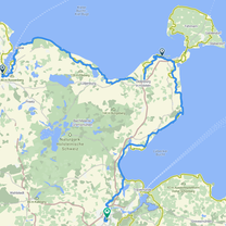
Kiel - Weißenhäuser Strand
A cycling route starting in Kiel, Schleswig-Holstein, Germany.
Overview
About this route
- 9 h 12 min
- Duration
- 73.6 km
- Distance
- 283 m
- Ascent
- 314 m
- Descent
- 8 km/h
- Avg. speed
- 41 m
- Max. altitude

Route photos

Continue with Bikemap
Use, edit, or download this cycling route
You would like to ride Kiel - Weißenhäuser Strand or customize it for your own trip? Here is what you can do with this Bikemap route:
Free features
- Save this route as favorite or in collections
- Copy & plan your own version of this route
- Sync your route with Garmin or Wahoo
Premium features
Free trial for 3 days, or one-time payment. More about Bikemap Premium.
- Navigate this route on iOS & Android
- Export a GPX / KML file of this route
- Create your custom printout (try it for free)
- Download this route for offline navigation
Discover more Premium features.
Get Bikemap PremiumFrom our community
Other popular routes starting in Kiel
 RS Kiel - Lübeck
- Distance
- 182 km
- Ascent
- 720 m
- Descent
- 709 m
- Location
- Kiel, Schleswig-Holstein, Germany
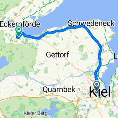 Von Kiel bis Eckernförde
- Distance
- 38.5 km
- Ascent
- 190 m
- Descent
- 186 m
- Location
- Kiel, Schleswig-Holstein, Germany
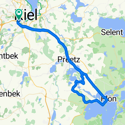 Controller Ascheberg
- Distance
- 68.9 km
- Ascent
- 477 m
- Descent
- 475 m
- Location
- Kiel, Schleswig-Holstein, Germany
 Kiel Süd-Ost (short)
- Distance
- 29.3 km
- Ascent
- 118 m
- Descent
- 120 m
- Location
- Kiel, Schleswig-Holstein, Germany
 Niemannsweg 101, Kiel nach Niemannsweg 102, Kiel
- Distance
- 39.1 km
- Ascent
- 216 m
- Descent
- 250 m
- Location
- Kiel, Schleswig-Holstein, Germany
 KielProceno
- Distance
- 2,102.8 km
- Ascent
- 3,263 m
- Descent
- 2,859 m
- Location
- Kiel, Schleswig-Holstein, Germany
- Kiel - Weißenhäuser Strand
- Distance
- 73.6 km
- Ascent
- 283 m
- Descent
- 314 m
- Location
- Kiel, Schleswig-Holstein, Germany
 Annenhof
- Distance
- 19.2 km
- Ascent
- 62 m
- Descent
- 63 m
- Location
- Kiel, Schleswig-Holstein, Germany
Open it in the app