

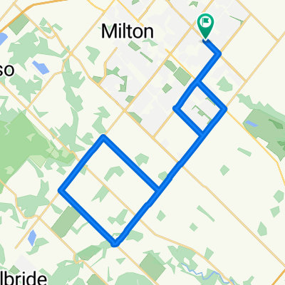
Woodward Ave, Milton to Woodward Ave, Milton
A cycling route starting in Milton, Ontario, Canada.
Overview
About this route
- 1 h 29 min
- Duration
- 17.5 km
- Distance
- 38 m
- Ascent
- 42 m
- Descent
- 11.8 km/h
- Avg. speed
- 209 m
- Max. altitude

Continue with Bikemap
Use, edit, or download this cycling route
You would like to ride Woodward Ave, Milton to Woodward Ave, Milton or customize it for your own trip? Here is what you can do with this Bikemap route:
Free features
- Save this route as favorite or in collections
- Copy & plan your own version of this route
- Sync your route with Garmin or Wahoo
Premium features
Free trial for 3 days, or one-time payment. More about Bikemap Premium.
- Navigate this route on iOS & Android
- Export a GPX / KML file of this route
- Create your custom printout (try it for free)
- Download this route for offline navigation
Discover more Premium features.
Get Bikemap PremiumFrom our community
Other popular routes starting in Milton
 Practice Route 03 - 38km
- Distance
- 38 km
- Ascent
- 112 m
- Descent
- 115 m
- Location
- Milton, Ontario, Canada
 May242025-TourDeIsmaili
- Distance
- 54.8 km
- Ascent
- 304 m
- Descent
- 307 m
- Location
- Milton, Ontario, Canada
 Brown Dog Coffee run - Paris.
- Distance
- 125 km
- Ascent
- 305 m
- Descent
- 315 m
- Location
- Milton, Ontario, Canada
 Hornby 80K
- Distance
- 75.4 km
- Ascent
- 330 m
- Descent
- 240 m
- Location
- Milton, Ontario, Canada
 KELSO Trail- Steeles Avenue West 5242, Milton to Steeles Avenue West 5301, Milton
- Distance
- 11.8 km
- Ascent
- 71 m
- Descent
- 95 m
- Location
- Milton, Ontario, Canada
 Woodward Ave, Milton to Woodward Ave, Milton
- Distance
- 17.5 km
- Ascent
- 38 m
- Descent
- 42 m
- Location
- Milton, Ontario, Canada
 100K - June 27
- Distance
- 99.6 km
- Ascent
- 336 m
- Descent
- 337 m
- Location
- Milton, Ontario, Canada
 26K Start Season - Not much Hill
- Distance
- 27.6 km
- Ascent
- 86 m
- Descent
- 87 m
- Location
- Milton, Ontario, Canada
Open it in the app