

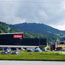
Weinbergerhaus / Brentenjoch Trail
A cycling route starting in Bad Häring, Tyrol, Austria.
Overview
About this route
oben sehr flowig unten technisch! Achtung erst gegen Abends fahren wo keine Fußgänger unterwegs sind. Vor allem das Verbindungsstück zur Duxeralm ist sehr stufig und auch mit einem Fahrverbotsschild gekennzeichnet. Der untere Teil wird sehr technisch
- -:--
- Duration
- 42.9 km
- Distance
- 989 m
- Ascent
- 989 m
- Descent
- ---
- Avg. speed
- ---
- Max. altitude
Continue with Bikemap
Use, edit, or download this cycling route
You would like to ride Weinbergerhaus / Brentenjoch Trail or customize it for your own trip? Here is what you can do with this Bikemap route:
Free features
- Save this route as favorite or in collections
- Copy & plan your own version of this route
- Sync your route with Garmin or Wahoo
Premium features
Free trial for 3 days, or one-time payment. More about Bikemap Premium.
- Navigate this route on iOS & Android
- Export a GPX / KML file of this route
- Create your custom printout (try it for free)
- Download this route for offline navigation
Discover more Premium features.
Get Bikemap PremiumFrom our community
Other popular routes starting in Bad Häring
 Buzler JW Stans bis Fritzens-Wattens
- Distance
- 54 km
- Ascent
- 319 m
- Descent
- 325 m
- Location
- Bad Häring, Tyrol, Austria
 Weinbergerhaus / Brentenjoch Trail
- Distance
- 42.9 km
- Ascent
- 989 m
- Descent
- 989 m
- Location
- Bad Häring, Tyrol, Austria
 12. Etappe der Italientour
- Distance
- 182.7 km
- Ascent
- 667 m
- Descent
- 934 m
- Location
- Bad Häring, Tyrol, Austria
 kirchbichl-umrathshausen
- Distance
- 55.6 km
- Ascent
- 443 m
- Descent
- 340 m
- Location
- Bad Häring, Tyrol, Austria
 Rund um den Pölven
- Distance
- 32 km
- Ascent
- 556 m
- Descent
- 556 m
- Location
- Bad Häring, Tyrol, Austria
 Kirchbichl-Achenbrenner -Kaindlhütte-Waller Alm-Kirchbichl
- Distance
- 41.2 km
- Ascent
- 1,216 m
- Descent
- 1,218 m
- Location
- Bad Häring, Tyrol, Austria
 Auffach-Siedeljoch-Langer Grund
- Distance
- 67.3 km
- Ascent
- 1,537 m
- Descent
- 1,539 m
- Location
- Bad Häring, Tyrol, Austria
 Bad Häring - Rattenberg - Kramsach - Museum Tiroler Bauernhöfe (mit Kirchtag)
- Distance
- 58.9 km
- Ascent
- 452 m
- Descent
- 452 m
- Location
- Bad Häring, Tyrol, Austria
Open it in the app