

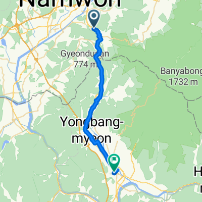
하도길, 남원시에서 천거동, 남원시까지
A cycling route starting in Namwon, Jeollabuk-do, South Korea.
Overview
About this route
- 1 h 3 min
- Duration
- 18.3 km
- Distance
- 65 m
- Ascent
- 25 m
- Descent
- 17.3 km/h
- Avg. speed
- 103 m
- Max. altitude

Route quality
Waytypes & surfaces along the route
Waytypes
Cycleway
10.8 km
(59 %)
Road
4 km
(22 %)
Surfaces
Paved
8.8 km
(48 %)
Concrete
6 km
(33 %)
Asphalt
2.7 km
(15 %)
Undefined
9.5 km
(52 %)
Continue with Bikemap
Use, edit, or download this cycling route
You would like to ride 하도길, 남원시에서 천거동, 남원시까지 or customize it for your own trip? Here is what you can do with this Bikemap route:
Free features
- Save this route as favorite or in collections
- Copy & plan your own version of this route
- Sync your route with Garmin or Wahoo
Premium features
Free trial for 3 days, or one-time payment. More about Bikemap Premium.
- Navigate this route on iOS & Android
- Export a GPX / KML file of this route
- Create your custom printout (try it for free)
- Download this route for offline navigation
Discover more Premium features.
Get Bikemap PremiumFrom our community
Other popular routes starting in Namwon
 20180722_Jirisan
- Distance
- 120.1 km
- Ascent
- 2,333 m
- Descent
- 2,332 m
- Location
- Namwon, Jeollabuk-do, South Korea
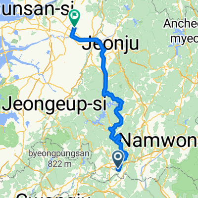
 Gokseongeup - Jeonju
- Distance
- 82.4 km
- Ascent
- 412 m
- Descent
- 451 m
- Location
- Namwon, Jeollabuk-do, South Korea
 De Jucheon-myeon 583-51 à Gurye-eup 579-1
- Distance
- 27.8 km
- Ascent
- 513 m
- Descent
- 428 m
- Location
- Namwon, Jeollabuk-do, South Korea
 Nangen - 익산시
- Distance
- 117.1 km
- Ascent
- 1,229 m
- Descent
- 1,273 m
- Location
- Namwon, Jeollabuk-do, South Korea
 ㅁㄴㄹㅇㅁㄴㅇㅀㄴㄹ
- Distance
- 100.8 km
- Ascent
- 1,783 m
- Descent
- 1,784 m
- Location
- Namwon, Jeollabuk-do, South Korea
 하도길, 남원시에서 천거동, 남원시까지
- Distance
- 18.3 km
- Ascent
- 65 m
- Descent
- 25 m
- Location
- Namwon, Jeollabuk-do, South Korea
 광치동 561-39, 남원시 to 광치동 561-39, 남원시
- Distance
- 49.7 km
- Ascent
- 405 m
- Descent
- 404 m
- Location
- Namwon, Jeollabuk-do, South Korea
 도통동, 남원시 to 도통동, 남원시
- Distance
- 235.1 km
- Ascent
- 7,293 m
- Descent
- 7,293 m
- Location
- Namwon, Jeollabuk-do, South Korea
Open it in the app