

Calle Glorieta Revolución, San Luis Potosí a Calle Andrés Olmos, San Luis Potosí
A cycling route starting in San Luis Potosí City, San Luis Potosí, Mexico.
Overview
About this route
- 43 min
- Duration
- 11.6 km
- Distance
- 70 m
- Ascent
- 74 m
- Descent
- 16.3 km/h
- Avg. speed
- 1,897 m
- Max. altitude
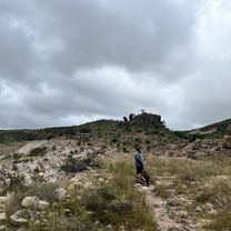
Route photos


Route quality
Waytypes & surfaces along the route
Waytypes
Quiet road
0.9 km
(8 %)
Access road
0.2 km
(2 %)
Surfaces
Paved
4.7 km
(40 %)
Concrete
4.5 km
(39 %)
Asphalt
0.1 km
(1 %)
Undefined
7 km
(60 %)
Continue with Bikemap
Use, edit, or download this cycling route
You would like to ride Calle Glorieta Revolución, San Luis Potosí a Calle Andrés Olmos, San Luis Potosí or customize it for your own trip? Here is what you can do with this Bikemap route:
Free features
- Save this route as favorite or in collections
- Copy & plan your own version of this route
- Sync your route with Garmin or Wahoo
Premium features
Free trial for 3 days, or one-time payment. More about Bikemap Premium.
- Navigate this route on iOS & Android
- Export a GPX / KML file of this route
- Create your custom printout (try it for free)
- Download this route for offline navigation
Discover more Premium features.
Get Bikemap PremiumFrom our community
Other popular routes starting in San Luis Potosí City
 casa - presa - pitina
- Distance
- 27.7 km
- Ascent
- 241 m
- Descent
- 233 m
- Location
- San Luis Potosí City, San Luis Potosí, Mexico
 Cañada De Lobo
- Distance
- 19.3 km
- Ascent
- 153 m
- Descent
- 156 m
- Location
- San Luis Potosí City, San Luis Potosí, Mexico
 Dorado-UTAN
- Distance
- 2.5 km
- Ascent
- 0 m
- Descent
- 4 m
- Location
- San Luis Potosí City, San Luis Potosí, Mexico
 al trabajo
- Distance
- 7 km
- Ascent
- 142 m
- Descent
- 128 m
- Location
- San Luis Potosí City, San Luis Potosí, Mexico
 Día 1
Día 1- Distance
- 96.6 km
- Ascent
- 939 m
- Descent
- 728 m
- Location
- San Luis Potosí City, San Luis Potosí, Mexico
 ruta terracería
- Distance
- 16.2 km
- Ascent
- 265 m
- Descent
- 265 m
- Location
- San Luis Potosí City, San Luis Potosí, Mexico
 San Luis Potosí a San Luis Potosí
- Distance
- 18.5 km
- Ascent
- 493 m
- Descent
- 501 m
- Location
- San Luis Potosí City, San Luis Potosí, Mexico
- Calle Glorieta Revolución, San Luis Potosí a Calle Andrés Olmos, San Luis Potosí
- Distance
- 11.6 km
- Ascent
- 70 m
- Descent
- 74 m
- Location
- San Luis Potosí City, San Luis Potosí, Mexico
Open it in the app