2003 Eder-Fulda-Sinntal-Main
A cycling route starting in Wabern, Hesse, Germany.
Overview
About this route
3-4 Tage von Wabern bis ins Werntal
Wasserscheide Fulda - Sinn ziemlich heftig,auf 800m hoch!!
dann wieder runter...aber nich ins Sinntal,sondern noch Ulstertal,also wieder rauf KOTZ...(also unbedingt oben bleiben wer ins Sinntal will,direkt an Bayr./Hessicher Grenze auf Höhenlinie durch die heide rübermachen...
dann erst ma Bundesstrasse runter geflogen ins Sinntal...
im Sinntal teils eher auf der Landstrasse als auf dem Radweg,der führt zuviel hoch un runter über nicht asfaltierte Wege un die Strasse rollt gut...
- -:--
- Duration
- 312 km
- Distance
- 2,432 m
- Ascent
- 2,439 m
- Descent
- ---
- Avg. speed
- 755 m
- Avg. speed
Route quality
Waytypes & surfaces along the route
Waytypes
Track
79.1 km
(25 %)
Busy road
62.6 km
(20 %)
Surfaces
Paved
251.6 km
(81 %)
Unpaved
25.2 km
(8 %)
Asphalt
234.5 km
(75 %)
Gravel
18.4 km
(6 %)
Route highlights
Points of interest along the route
Point of interest after 98.7 km
Ü Platz
Point of interest after 214.2 km
Hängematte
Point of interest after 216.9 km
Hängematte
Point of interest after 221.9 km
Ü Platz
Point of interest after 284.7 km
Ü Platz
Continue with Bikemap
Use, edit, or download this cycling route
You would like to ride 2003 Eder-Fulda-Sinntal-Main or customize it for your own trip? Here is what you can do with this Bikemap route:
Free features
- Save this route as favorite or in collections
- Copy & plan your own version of this route
- Sync your route with Garmin or Wahoo
Premium features
Free trial for 3 days, or one-time payment. More about Bikemap Premium.
- Navigate this route on iOS & Android
- Export a GPX / KML file of this route
- Create your custom printout (try it for free)
- Download this route for offline navigation
Discover more Premium features.
Get Bikemap PremiumFrom our community
Other popular routes starting in Wabern
- 2002 Von der Eder zur Weser
- Distance
- 207.4 km
- Ascent
- 1,332 m
- Descent
- 1,416 m
- Location
- Wabern, Hesse, Germany
- things to do
- Distance
- 111.1 km
- Ascent
- 1,072 m
- Descent
- 1,072 m
- Location
- Wabern, Hesse, Germany
- Expedition Knüll
- Distance
- 62.7 km
- Ascent
- 1,153 m
- Descent
- 1,154 m
- Location
- Wabern, Hesse, Germany
- Wabern Meißner
- Distance
- 115.2 km
- Ascent
- 1,242 m
- Descent
- 1,240 m
- Location
- Wabern, Hesse, Germany
- Felsberg - Gudensberg
- Distance
- 42.5 km
- Ascent
- 263 m
- Descent
- 263 m
- Location
- Wabern, Hesse, Germany
- Wabern-Borken-Fritzlar-Felsberg-Wabern
- Distance
- 43.1 km
- Ascent
- 184 m
- Descent
- 184 m
- Location
- Wabern, Hesse, Germany
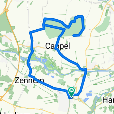
- Chattengau-Eder Runde
- Distance
- 43.9 km
- Ascent
- 401 m
- Descent
- 400 m
- Location
- Wabern, Hesse, Germany
- Wabern-Caßdorf-Frielendorf-Borken-Wabern
- Distance
- 47.4 km
- Ascent
- 258 m
- Descent
- 258 m
- Location
- Wabern, Hesse, Germany
Open it in the app