

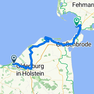
Weißenßäuser Strand - Grömitz
A cycling route starting in Wangels, Schleswig-Holstein, Germany.
Overview
About this route
- 5 h 45 min
- Duration
- 64.9 km
- Distance
- 229 m
- Ascent
- 240 m
- Descent
- 11.3 km/h
- Avg. speed
- 36 m
- Max. altitude

Route photos

Route quality
Waytypes & surfaces along the route
Waytypes
Quiet road
24.4 km
(38 %)
Path
16.3 km
(25 %)
Surfaces
Paved
48.2 km
(74 %)
Unpaved
8.7 km
(13 %)
Asphalt
42 km
(65 %)
Gravel
5.1 km
(8 %)
Continue with Bikemap
Use, edit, or download this cycling route
You would like to ride Weißenßäuser Strand - Grömitz or customize it for your own trip? Here is what you can do with this Bikemap route:
Free features
- Save this route as favorite or in collections
- Copy & plan your own version of this route
- Sync your route with Garmin or Wahoo
Premium features
Free trial for 3 days, or one-time payment. More about Bikemap Premium.
- Navigate this route on iOS & Android
- Export a GPX / KML file of this route
- Create your custom printout (try it for free)
- Download this route for offline navigation
Discover more Premium features.
Get Bikemap PremiumFrom our community
Other popular routes starting in Wangels
 WeißenhäuserStrand
- Distance
- 49.8 km
- Ascent
- 124 m
- Descent
- 123 m
- Location
- Wangels, Schleswig-Holstein, Germany
- Weißenßäuser Strand - Grömitz
- Distance
- 64.9 km
- Ascent
- 229 m
- Descent
- 240 m
- Location
- Wangels, Schleswig-Holstein, Germany
 OKR 1.5 _ Weißenhäuser Strand - Strukkamphuk
- Distance
- 39.6 km
- Ascent
- 87 m
- Descent
- 84 m
- Location
- Wangels, Schleswig-Holstein, Germany
 20230813 Weissenhäuser Strand nach Strande
- Distance
- 64 km
- Ascent
- 280 m
- Descent
- 280 m
- Location
- Wangels, Schleswig-Holstein, Germany
 Fischerweg 855, Wangels nach Fischerweg 1000E, Wangels
- Distance
- 15.9 km
- Ascent
- 115 m
- Descent
- 121 m
- Location
- Wangels, Schleswig-Holstein, Germany
 Lütjendorf und Küste
- Distance
- 33.4 km
- Ascent
- 141 m
- Descent
- 141 m
- Location
- Wangels, Schleswig-Holstein, Germany
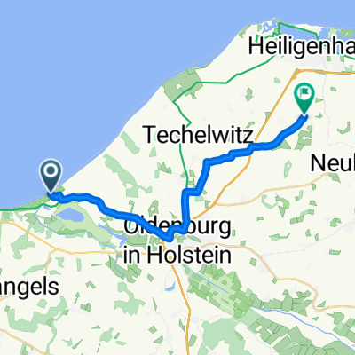
 Seestraße 1, Wangels nach Kirchhofstraße 5, Heiligenhafen
- Distance
- 21.1 km
- Ascent
- 97 m
- Descent
- 73 m
- Location
- Wangels, Schleswig-Holstein, Germany
 Recovered Route
- Distance
- 16.8 km
- Ascent
- 0 m
- Descent
- 3 m
- Location
- Wangels, Schleswig-Holstein, Germany
Open it in the app