
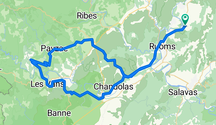
Brücke von Chambonas 75 km reicht
A cycling route starting in Ruoms, Auvergne-Rhône-Alpes, France.
Overview
About this route
- 4 h 56 min
- Duration
- 76.1 km
- Distance
- 1,497 m
- Ascent
- 1,496 m
- Descent
- 15.4 km/h
- Avg. speed
- 400 m
- Max. altitude

Route quality
Waytypes & surfaces along the route
Waytypes
Road
38.9 km
(51 %)
Quiet road
16.1 km
(21 %)
Surfaces
Paved
31.1 km
(41 %)
Unpaved
6.1 km
(8 %)
Asphalt
28.6 km
(38 %)
Unpaved (undefined)
4 km
(5 %)
Continue with Bikemap
Use, edit, or download this cycling route
You would like to ride Brücke von Chambonas 75 km reicht or customize it for your own trip? Here is what you can do with this Bikemap route:
Free features
- Save this route as favorite or in collections
- Copy & plan your own version of this route
- Sync your route with Garmin or Wahoo
Premium features
Free trial for 3 days, or one-time payment. More about Bikemap Premium.
- Navigate this route on iOS & Android
- Export a GPX / KML file of this route
- Create your custom printout (try it for free)
- Download this route for offline navigation
Discover more Premium features.
Get Bikemap PremiumFrom our community
Other popular routes starting in Ruoms
 Balazuc-LaPont
- Distance
- 16.9 km
- Ascent
- 230 m
- Descent
- 229 m
- Location
- Ruoms, Auvergne-Rhône-Alpes, France
 Chemin de Sevenier, Lagorce naar Chemin de Sevenier, Lagorce
- Distance
- 37.5 km
- Ascent
- 559 m
- Descent
- 558 m
- Location
- Ruoms, Auvergne-Rhône-Alpes, France
 Ardeche Runde
- Distance
- 47.6 km
- Ascent
- 1,102 m
- Descent
- 1,003 m
- Location
- Ruoms, Auvergne-Rhône-Alpes, France
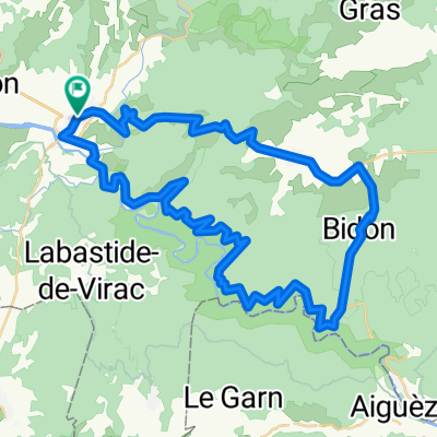 Vallon Pont d'Arc -Bidon-Gorges Ardèche
- Distance
- 51.8 km
- Ascent
- 594 m
- Descent
- 594 m
- Location
- Ruoms, Auvergne-Rhône-Alpes, France
 Pradons Sampzon 30km
- Distance
- 33.7 km
- Ascent
- 642 m
- Descent
- 635 m
- Location
- Ruoms, Auvergne-Rhône-Alpes, France
 Chemin de Faussimagne, Chauzon nach Chemin de Faussimagne, Chauzon
- Distance
- 29.1 km
- Ascent
- 269 m
- Descent
- 271 m
- Location
- Ruoms, Auvergne-Rhône-Alpes, France
 Vallon-Pont-d'Arc Panoramaroute va 60km
- Distance
- 56.3 km
- Ascent
- 2,301 m
- Descent
- 2,300 m
- Location
- Ruoms, Auvergne-Rhône-Alpes, France
 Virac - Barjac dh
- Distance
- 36.4 km
- Ascent
- 508 m
- Descent
- 514 m
- Location
- Ruoms, Auvergne-Rhône-Alpes, France
Open it in the app