

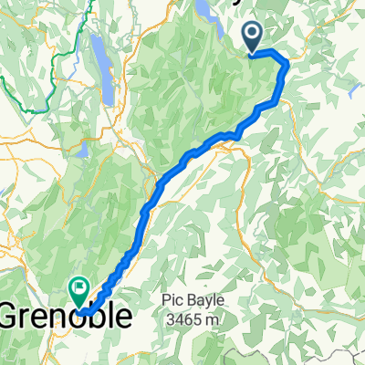
J2 - Etape du Tour - Col des Près + Cormet
A cycling route starting in Faverges, Auvergne-Rhône-Alpes, France.
Overview
About this route
- 11 h 1 min
- Duration
- 139.1 km
- Distance
- 4,860 m
- Ascent
- 4,861 m
- Descent
- 12.6 km/h
- Avg. speed
- 1,974 m
- Max. altitude
Continue with Bikemap
Use, edit, or download this cycling route
You would like to ride J2 - Etape du Tour - Col des Près + Cormet or customize it for your own trip? Here is what you can do with this Bikemap route:
Free features
- Save this route as favorite or in collections
- Copy & plan your own version of this route
- Split it into stages to create a multi-day tour
- Sync your route with Garmin or Wahoo
Premium features
Free trial for 3 days, or one-time payment. More about Bikemap Premium.
- Navigate this route on iOS & Android
- Export a GPX / KML file of this route
- Create your custom printout (try it for free)
- Download this route for offline navigation
Discover more Premium features.
Get Bikemap PremiumFrom our community
Other popular routes starting in Faverges
 Alpes 2015 - Marlens - Sortie n°8
- Distance
- 76.6 km
- Ascent
- 1,042 m
- Descent
- 1,042 m
- Location
- Faverges, Auvergne-Rhône-Alpes, France
 Gravel en Bauges 2 variante sauvage
- Distance
- 80.4 km
- Ascent
- 2,942 m
- Descent
- 2,939 m
- Location
- Faverges, Auvergne-Rhône-Alpes, France
 Clairvaux-les-Lacs - Faverges
- Distance
- 216.8 km
- Ascent
- 3,027 m
- Descent
- 2,968 m
- Location
- Faverges, Auvergne-Rhône-Alpes, France
 Tour 2016 - Col du Tamie, 99 km/1650 m
- Distance
- 98.9 km
- Ascent
- 1,489 m
- Descent
- 1,490 m
- Location
- Faverges, Auvergne-Rhône-Alpes, France
 10_Saint-Ferréol_Meylan
- Distance
- 107.3 km
- Ascent
- 217 m
- Descent
- 499 m
- Location
- Faverges, Auvergne-Rhône-Alpes, France
 Gravel en Bauges 2
- Distance
- 82.5 km
- Ascent
- 2,646 m
- Descent
- 2,643 m
- Location
- Faverges, Auvergne-Rhône-Alpes, France
 Col de Tamié
- Distance
- 44.4 km
- Ascent
- 825 m
- Descent
- 828 m
- Location
- Faverges, Auvergne-Rhône-Alpes, France
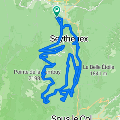 Faverges-Seythenex
- Distance
- 46.5 km
- Ascent
- 2,874 m
- Descent
- 2,857 m
- Location
- Faverges, Auvergne-Rhône-Alpes, France
Open it in the app