

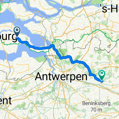
Untitled route
A cycling route starting in Goes, Zeeland, The Netherlands.
Overview
About this route
- 4 h 35 min
- Duration
- 77.9 km
- Distance
- 64 m
- Ascent
- 65 m
- Descent
- 17 km/h
- Avg. speed
- 11 m
- Max. altitude
Route quality
Waytypes & surfaces along the route
Waytypes
Cycleway
50.7 km
(65 %)
Quiet road
26.5 km
(34 %)
Road
0.8 km
(1 %)
Surfaces
Paved
44.4 km
(57 %)
Unpaved
2.3 km
(3 %)
Asphalt
42.9 km
(55 %)
Gravel
2.3 km
(3 %)
Continue with Bikemap
Use, edit, or download this cycling route
You would like to ride Untitled route or customize it for your own trip? Here is what you can do with this Bikemap route:
Free features
- Save this route as favorite or in collections
- Copy & plan your own version of this route
- Sync your route with Garmin or Wahoo
Premium features
Free trial for 3 days, or one-time payment. More about Bikemap Premium.
- Navigate this route on iOS & Android
- Export a GPX / KML file of this route
- Create your custom printout (try it for free)
- Download this route for offline navigation
Discover more Premium features.
Get Bikemap PremiumFrom our community
Other popular routes starting in Goes
 15.06.15 Langs boomgaarden en welen
- Distance
- 54.9 km
- Ascent
- 6 m
- Descent
- 5 m
- Location
- Goes, Zeeland, The Netherlands
 MTB Borssele / Heinkenszand route 16KM
- Distance
- 15.7 km
- Ascent
- 0 m
- Descent
- 0 m
- Location
- Goes, Zeeland, The Netherlands
 125 km durch Beveland und Duiveland
- Distance
- 122.8 km
- Ascent
- 40 m
- Descent
- 36 m
- Location
- Goes, Zeeland, The Netherlands
 Route Zak Zuid-Beveland - Camping 't Veerse Meer
- Distance
- 69.8 km
- Ascent
- 0 m
- Descent
- 0 m
- Location
- Goes, Zeeland, The Netherlands
 Fietstripje Nederland Dag 2
- Distance
- 39.9 km
- Ascent
- 0 m
- Descent
- 0 m
- Location
- Goes, Zeeland, The Netherlands
 oefen ronde
- Distance
- 24 km
- Ascent
- 0 m
- Descent
- 0 m
- Location
- Goes, Zeeland, The Netherlands
 Lokeren - Tessenderlo
- Distance
- 93.7 km
- Ascent
- 222 m
- Descent
- 187 m
- Location
- Goes, Zeeland, The Netherlands
 MBT - Fiets Router Oude SloeSpoor
- Distance
- 32.3 km
- Ascent
- 0 m
- Descent
- 0 m
- Location
- Goes, Zeeland, The Netherlands
Open it in the app