

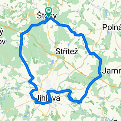
Štoky-Čelákovice-Neratovice
A cycling route starting in Štoky, Kraj Vysočina, Czechia.
Overview
About this route
- -:--
- Duration
- 152.9 km
- Distance
- 558 m
- Ascent
- 928 m
- Descent
- ---
- Avg. speed
- ---
- Max. altitude

Route quality
Waytypes & surfaces along the route
Waytypes
Road
61.1 km
(40 %)
Quiet road
16.8 km
(11 %)
Surfaces
Paved
71.9 km
(47 %)
Unpaved
3.1 km
(2 %)
Asphalt
65.7 km
(43 %)
Paved (undefined)
4.6 km
(3 %)
Continue with Bikemap
Use, edit, or download this cycling route
You would like to ride Štoky-Čelákovice-Neratovice or customize it for your own trip? Here is what you can do with this Bikemap route:
Free features
- Save this route as favorite or in collections
- Copy & plan your own version of this route
- Split it into stages to create a multi-day tour
- Sync your route with Garmin or Wahoo
Premium features
Free trial for 3 days, or one-time payment. More about Bikemap Premium.
- Navigate this route on iOS & Android
- Export a GPX / KML file of this route
- Create your custom printout (try it for free)
- Download this route for offline navigation
Discover more Premium features.
Get Bikemap PremiumFrom our community
Other popular routes starting in Štoky
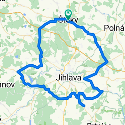 Tour de Jihlava
- Distance
- 73.9 km
- Ascent
- 723 m
- Descent
- 726 m
- Location
- Štoky, Kraj Vysočina, Czechia
 Vetrny Jenikov
- Distance
- 122.4 km
- Ascent
- 591 m
- Descent
- 1,034 m
- Location
- Štoky, Kraj Vysočina, Czechia
 Větrný Jeníkov - Herálec - Štoky
- Distance
- 44.3 km
- Ascent
- 592 m
- Descent
- 643 m
- Location
- Štoky, Kraj Vysočina, Czechia
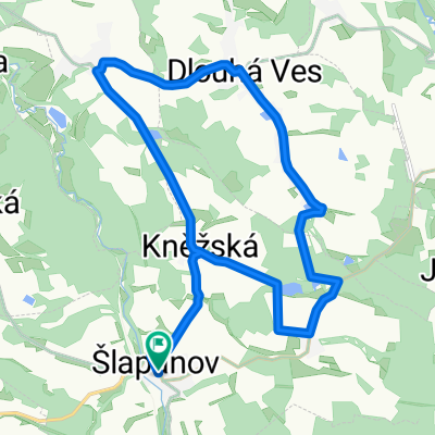 Šlapanov - Dlouhá Ves
- Distance
- 16.4 km
- Ascent
- 180 m
- Descent
- 183 m
- Location
- Štoky, Kraj Vysočina, Czechia
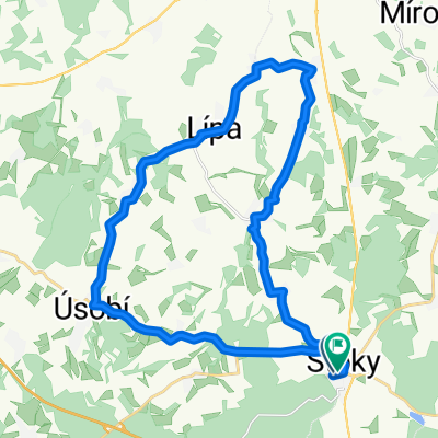 okolo stoku
- Distance
- 26.9 km
- Ascent
- 353 m
- Descent
- 358 m
- Location
- Štoky, Kraj Vysočina, Czechia
 Štoky-Čelákovice-Neratovice
- Distance
- 152.9 km
- Ascent
- 558 m
- Descent
- 928 m
- Location
- Štoky, Kraj Vysočina, Czechia
 M+P Tour I
- Distance
- 49.1 km
- Ascent
- 471 m
- Descent
- 471 m
- Location
- Štoky, Kraj Vysočina, Czechia
 Štoky-Třebíč
- Distance
- 52 km
- Ascent
- 575 m
- Descent
- 664 m
- Location
- Štoky, Kraj Vysočina, Czechia
Open it in the app