
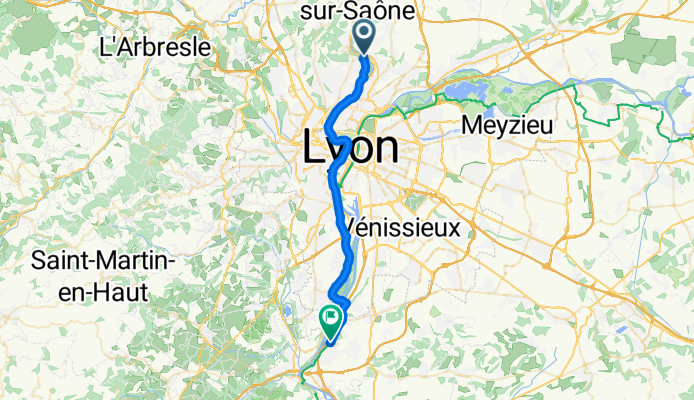
Quai de la Libération, Collonges-au-Mont-d'Or to 5 Chemin de la Chaîne, Ternay
A cycling route starting in Fontaines-sur-Saône, Auvergne-Rhône-Alpes, France.
Overview
About this route
- 1 h 32 min
- Duration
- 30.1 km
- Distance
- 243 m
- Ascent
- 243 m
- Descent
- 19.6 km/h
- Avg. speed
- 211 m
- Max. altitude
Route quality
Waytypes & surfaces along the route
Waytypes
Cycleway
8.7 km
(29 %)
Road
5.4 km
(18 %)
Surfaces
Paved
24.4 km
(81 %)
Asphalt
23.2 km
(77 %)
Concrete
1.2 km
(4 %)
Undefined
5.7 km
(19 %)
Continue with Bikemap
Use, edit, or download this cycling route
You would like to ride Quai de la Libération, Collonges-au-Mont-d'Or to 5 Chemin de la Chaîne, Ternay or customize it for your own trip? Here is what you can do with this Bikemap route:
Free features
- Save this route as favorite or in collections
- Copy & plan your own version of this route
- Sync your route with Garmin or Wahoo
Premium features
Free trial for 3 days, or one-time payment. More about Bikemap Premium.
- Navigate this route on iOS & Android
- Export a GPX / KML file of this route
- Create your custom printout (try it for free)
- Download this route for offline navigation
Discover more Premium features.
Get Bikemap PremiumFrom our community
Other popular routes starting in Fontaines-sur-Saône
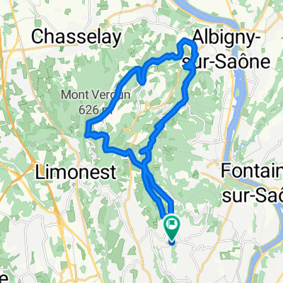
 Parcours dimanche 2302
- Distance
- 52.3 km
- Ascent
- 375 m
- Descent
- 377 m
- Location
- Fontaines-sur-Saône, Auvergne-Rhône-Alpes, France
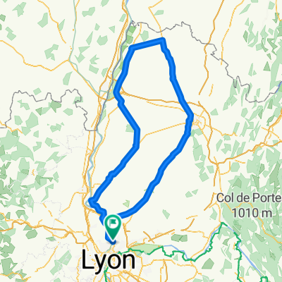
 c1 Le circuit de Béa
- Distance
- 19.5 km
- Ascent
- 186 m
- Descent
- 183 m
- Location
- Fontaines-sur-Saône, Auvergne-Rhône-Alpes, France
 L7: Fontaines-Saint-Martin - Roches-de-Condrieu; 67,1km 270hm
- Distance
- 67.1 km
- Ascent
- 432 m
- Descent
- 467 m
- Location
- Fontaines-sur-Saône, Auvergne-Rhône-Alpes, France
 L7 Abkürzung: Fontaines-Saint-Martin - Aurec-sur-Loire; 45+12km mit Bahn Givors-Firminy
- Distance
- 112.5 km
- Ascent
- 1,355 m
- Descent
- 1,099 m
- Location
- Fontaines-sur-Saône, Auvergne-Rhône-Alpes, France
 Margot route
- Distance
- 54.6 km
- Ascent
- 286 m
- Descent
- 285 m
- Location
- Fontaines-sur-Saône, Auvergne-Rhône-Alpes, France
 MTDOR_CLASSIC
- Distance
- 21.6 km
- Ascent
- 816 m
- Descent
- 813 m
- Location
- Fontaines-sur-Saône, Auvergne-Rhône-Alpes, France
 BIG DOMBES
- Distance
- 186.6 km
- Ascent
- 806 m
- Descent
- 807 m
- Location
- Fontaines-sur-Saône, Auvergne-Rhône-Alpes, France
 Fontaine-sur-Saône - Mâcon
- Distance
- 68.3 km
- Ascent
- 47 m
- Descent
- 42 m
- Location
- Fontaines-sur-Saône, Auvergne-Rhône-Alpes, France
Open it in the app