
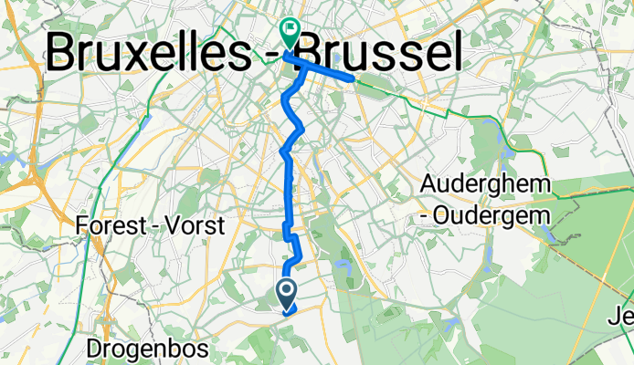
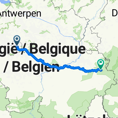
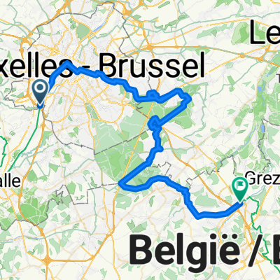
Avenue Jean et Pierre Carsoel, Uccle à Rue de l'Enseignement, Bruxelles
A cycling route starting in Drogenbos, Flemish Region, Belgium.
Overview
About this route
- 36 min
- Duration
- 10.2 km
- Distance
- 98 m
- Ascent
- 122 m
- Descent
- 16.9 km/h
- Avg. speed
- 113 m
- Max. altitude

Route quality
Waytypes & surfaces along the route
Waytypes
Quiet road
5.5 km
(54 %)
Cycleway
3.2 km
(31 %)
Surfaces
Paved
9.5 km
(93 %)
Asphalt
8.7 km
(85 %)
Concrete
0.8 km
(8 %)
Undefined
0.7 km
(7 %)
Continue with Bikemap
Use, edit, or download this cycling route
You would like to ride Avenue Jean et Pierre Carsoel, Uccle à Rue de l'Enseignement, Bruxelles or customize it for your own trip? Here is what you can do with this Bikemap route:
Free features
- Save this route as favorite or in collections
- Copy & plan your own version of this route
- Sync your route with Garmin or Wahoo
Premium features
Free trial for 3 days, or one-time payment. More about Bikemap Premium.
- Navigate this route on iOS & Android
- Export a GPX / KML file of this route
- Create your custom printout (try it for free)
- Download this route for offline navigation
Discover more Premium features.
Get Bikemap PremiumFrom our community
Other popular routes starting in Drogenbos
 Brussels - Tubize - Trouee d'Arenberg - Mons-en-Pevele - Pogacar's fall - carrefour l'arbre - Roubaix
- Distance
- 164 km
- Ascent
- 542 m
- Descent
- 617 m
- Location
- Drogenbos, Flemish Region, Belgium
 Brussels - Tubize - Trouee d'Arenberg
- Distance
- 166.6 km
- Ascent
- 545 m
- Descent
- 621 m
- Location
- Drogenbos, Flemish Region, Belgium
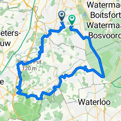
 Quick bike tour through Forest
- Distance
- 9.8 km
- Ascent
- 37 m
- Descent
- 21 m
- Location
- Drogenbos, Flemish Region, Belgium
 Depart-JLM-Uccle-40km-Proposal1
- Distance
- 40.6 km
- Ascent
- 349 m
- Descent
- 364 m
- Location
- Drogenbos, Flemish Region, Belgium
 Navodila za pot od točke Avenue Montjoie 35, Uccle do točke Signal de Botrange, Waimes - Navodila za pot od točke Avenue Montjoie 35, Uccle do točke Signal d...
- Distance
- 217.2 km
- Ascent
- 2,396 m
- Descent
- 1,820 m
- Location
- Drogenbos, Flemish Region, Belgium
 Linkebeek-Gottechain-Leuven-Schaerbeek
- Distance
- 81.1 km
- Ascent
- 485 m
- Descent
- 471 m
- Location
- Drogenbos, Flemish Region, Belgium
 01: Brussels – Wavre (DEVELOPED_WITH_SIGNS) - 02: Wavre – Namur (DEVELOPED_WITH_SIGNS) - 03: Namur – Dinant (DEVELOPED_WITH_SIGNS) - 04: Dinant – Marche-en-F...
- Distance
- 726.7 km
- Ascent
- 636 m
- Descent
- 612 m
- Location
- Drogenbos, Flemish Region, Belgium
 Grand'Route, Drogenbos à Hellestraat, Beersel
- Distance
- 14.6 km
- Ascent
- 69 m
- Descent
- 85 m
- Location
- Drogenbos, Flemish Region, Belgium
Open it in the app