
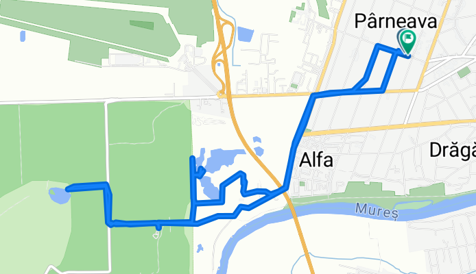
Strada Gheorghe Doja, Arad to Strada Gheorghe Doja, Arad
A cycling route starting in Arad, Arad County, Romania.
Overview
About this route
- 1 h 33 min
- Duration
- 11.4 km
- Distance
- 60 m
- Ascent
- 61 m
- Descent
- 7.3 km/h
- Avg. speed
- 128 m
- Max. altitude

Route photos


Continue with Bikemap
Use, edit, or download this cycling route
You would like to ride Strada Gheorghe Doja, Arad to Strada Gheorghe Doja, Arad or customize it for your own trip? Here is what you can do with this Bikemap route:
Free features
- Save this route as favorite or in collections
- Copy & plan your own version of this route
- Sync your route with Garmin or Wahoo
Premium features
Free trial for 3 days, or one-time payment. More about Bikemap Premium.
- Navigate this route on iOS & Android
- Export a GPX / KML file of this route
- Create your custom printout (try it for free)
- Download this route for offline navigation
Discover more Premium features.
Get Bikemap PremiumFrom our community
Other popular routes starting in Arad
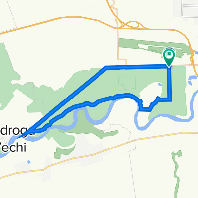 Circuit Ceala
- Distance
- 16.5 km
- Ascent
- 73 m
- Descent
- 65 m
- Location
- Arad, Arad County, Romania
 Malul Mureșului
- Distance
- 16.3 km
- Ascent
- 30 m
- Descent
- 28 m
- Location
- Arad, Arad County, Romania
 Arad-Vladimirescu forest-Arad
- Distance
- 36 km
- Ascent
- 57 m
- Descent
- 56 m
- Location
- Arad, Arad County, Romania
 Traseu alternativ la dunga albastră
- Distance
- 6.6 km
- Ascent
- 35 m
- Descent
- 37 m
- Location
- Arad, Arad County, Romania
- Strada Gheorghe Doja, Arad to Strada Gheorghe Doja, Arad
- Distance
- 11.4 km
- Ascent
- 60 m
- Descent
- 61 m
- Location
- Arad, Arad County, Romania
 Arad-Vladimirescu (Safary)
- Distance
- 18.9 km
- Ascent
- 43 m
- Descent
- 43 m
- Location
- Arad, Arad County, Romania
 RandoROM 200 2019
- Distance
- 204 km
- Ascent
- 205 m
- Descent
- 207 m
- Location
- Arad, Arad County, Romania
 Cupa Lunca Muresului 2012
- Distance
- 39.4 km
- Ascent
- 87 m
- Descent
- 87 m
- Location
- Arad, Arad County, Romania
Open it in the app