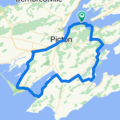
Waterfront Trail: Quinte/Kingston
- 18.6 km
- 100 m
- 113 m
- Picton, Ontario, Canada
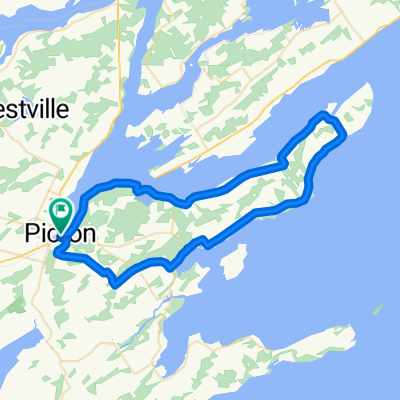
Waterfront Trail: Lake Ontario–St. Lawrence (Canada)
A cycling route starting in Picton, Ontario, Canada.
Overview
Short spin from Picton along the Waterfront Trail's Quinte/Kingston section. Expect smooth pavement and gentle rollers (about 100 m total climbing) over roughly 19 km. You'll catch Lake Ontario views and pass marinas and cafes, with a few busier road sections—ride single file and use lights if needed. Perfect pre-winery ride or coffee run, finishing back in Picton.
Part of
Waterfront Trail: Lake Ontario–St. Lawrence (Canada)
33 routes
Route quality
Cycleway
1.1 km
(6 %)
Quiet road
0.7 km
(4 %)
Paved
16.9 km
(91 %)
Unpaved
0.2 km
(1 %)
Asphalt
16.9 km
(91 %)
Unpaved (undefined)
0.2 km
(1 %)
Undefined
1.5 km
(8 %)
Continue with Bikemap
You would like to ride Waterfront Trail: Quinte/Kingston or customize it for your own trip? Here is what you can do with this Bikemap route:
Free trial for 3 days, or one-time payment. More about Bikemap Premium.
Discover more Premium features.
Get Bikemap PremiumFrom our community
Open it in the app