

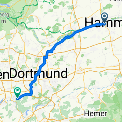
Friedrich-Ebert-Straße Schulze Rötering Prozessionsweg, Ahlen
A cycling route starting in Hamm, North Rhine-Westphalia, Germany.
Overview
About this route
- 1 h 1 min
- Duration
- 18.3 km
- Distance
- 50 m
- Ascent
- 62 m
- Descent
- 17.9 km/h
- Avg. speed
- 97 m
- Max. altitude

Route quality
Waytypes & surfaces along the route
Waytypes
Quiet road
10.2 km
(56 %)
Path
8 km
(44 %)
Surfaces
Paved
17.2 km
(94 %)
Unpaved
0.9 km
(5 %)
Asphalt
17.2 km
(94 %)
Loose gravel
0.9 km
(5 %)
Undefined
0.2 km
(1 %)
Continue with Bikemap
Use, edit, or download this cycling route
You would like to ride Friedrich-Ebert-Straße Schulze Rötering Prozessionsweg, Ahlen or customize it for your own trip? Here is what you can do with this Bikemap route:
Free features
- Save this route as favorite or in collections
- Copy & plan your own version of this route
- Sync your route with Garmin or Wahoo
Premium features
Free trial for 3 days, or one-time payment. More about Bikemap Premium.
- Navigate this route on iOS & Android
- Export a GPX / KML file of this route
- Create your custom printout (try it for free)
- Download this route for offline navigation
Discover more Premium features.
Get Bikemap PremiumFrom our community
Other popular routes starting in Hamm
 B-Hövel--Schoß Westerwinkel--B-Hövel
- Distance
- 36 km
- Ascent
- 117 m
- Descent
- 115 m
- Location
- Hamm, North Rhine-Westphalia, Germany
 Kentroper Weg nach Kentroper Weg
- Distance
- 14.9 km
- Ascent
- 34 m
- Descent
- 35 m
- Location
- Hamm, North Rhine-Westphalia, Germany
 Lange Radrunde durch Hamm
- Distance
- 32.2 km
- Ascent
- 135 m
- Descent
- 132 m
- Location
- Hamm, North Rhine-Westphalia, Germany
 Von Datteln bis Witten
- Distance
- 53.4 km
- Ascent
- 237 m
- Descent
- 169 m
- Location
- Hamm, North Rhine-Westphalia, Germany
 Ennigerberg nach Adelheidisstraße
- Distance
- 160.7 km
- Ascent
- 809 m
- Descent
- 868 m
- Location
- Hamm, North Rhine-Westphalia, Germany
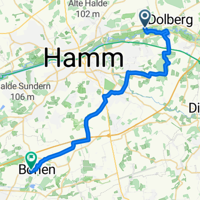 Von Schloss Oberwerries, Hamm bis Bönen
- Distance
- 24.9 km
- Ascent
- 56 m
- Descent
- 48 m
- Location
- Hamm, North Rhine-Westphalia, Germany
 Radrunde Hammer Osten
- Distance
- 20.9 km
- Ascent
- 52 m
- Descent
- 52 m
- Location
- Hamm, North Rhine-Westphalia, Germany
 leichte Möhneseeroute
- Distance
- 38.7 km
- Ascent
- 192 m
- Descent
- 40 m
- Location
- Hamm, North Rhine-Westphalia, Germany
Open it in the app