Alb-Tor-Tour 2010 red.
- 62.1 km
- 900 m
- 900 m
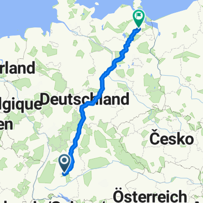
- Kohlberg, Baden-Wurttemberg, Germany
Orchard Cycle Route (Streuobst-Radroute)
A cycling route starting in Kohlberg, Baden-Wurttemberg, Germany.
Overview
Roll from Kohlberg through orchard meadows toward the Alb, mostly on quiet farm tracks and backroads. It’s about 12 km with a gentle net downhill, so it rides easy. Expect wide views and a few short rises near the fields. Glide into Owen at the foot of Burg Teck—perfect for a coffee stop or a quick detour up to the castle if you’ve got legs left. Surfaces are mostly paved and smooth; great for any bike.
Part of
Orchard Cycle Route (Streuobst-Radroute)
13 routes
Route quality
Track
5.6 km
(47 %)
Quiet road
4 km
(33 %)
Paved
10.8 km
(90 %)
Unpaved
0.4 km
(3 %)
Asphalt
9 km
(75 %)
Paved (undefined)
1.8 km
(15 %)
Continue with Bikemap
You would like to ride Streuobst-Radroute Kohlberg - Owen or customize it for your own trip? Here is what you can do with this Bikemap route:
Free trial for 3 days, or one-time payment. More about Bikemap Premium.
Discover more Premium features.
Get Bikemap PremiumFrom our community
Open it in the app