試しルート
A cycling route starting in Machida, Tokyo, Japan.
Overview
About this route
- 39 h 16 min
- Duration
- 657.1 km
- Distance
- 5,370 m
- Ascent
- 5,422 m
- Descent
- 16.7 km/h
- Avg. speed
- 784 m
- Avg. speed
Route quality
Waytypes & surfaces along the route
Waytypes
Quiet road
410.6 km
(62 %)
Cycleway
139.5 km
(21 %)
Surfaces
Paved
98.4 km
(15 %)
Unpaved
3.6 km
(<1 %)
Asphalt
54.3 km
(8 %)
Paved (undefined)
42.5 km
(6 %)
Continue with Bikemap
Use, edit, or download this cycling route
You would like to ride 試しルート or customize it for your own trip? Here is what you can do with this Bikemap route:
Free features
- Save this route as favorite or in collections
- Copy & plan your own version of this route
- Sync your route with Garmin or Wahoo
Premium features
Free trial for 3 days, or one-time payment. More about Bikemap Premium.
- Navigate this route on iOS & Android
- Export a GPX / KML file of this route
- Create your custom printout (try it for free)
- Download this route for offline navigation
Discover more Premium features.
Get Bikemap PremiumFrom our community
Other popular routes starting in Machida
- 試しルート
- Distance
- 657.1 km
- Ascent
- 5,370 m
- Descent
- 5,422 m
- Location
- Machida, Tokyo, Japan
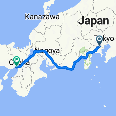
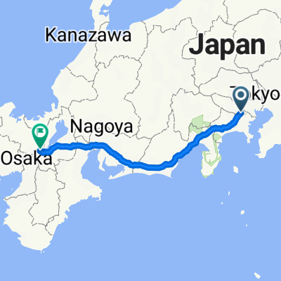
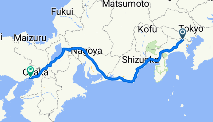
- 16-28, Edaminami 5-Chōme, Tsuzuki-Ku, Yokohama-Shi to 16-28, Edaminami 5-Chōme, Tsuzuki-Ku, Yokohama-Shi
- Distance
- 191.1 km
- Ascent
- 3,470 m
- Descent
- 3,470 m
- Location
- Machida, Tokyo, Japan
- 2丁目 25, 川崎市 to 442−1, 京都市
- Distance
- 466.3 km
- Ascent
- 4,482 m
- Descent
- 4,469 m
- Location
- Machida, Tokyo, Japan
- Phase 1
- Distance
- 42.4 km
- Ascent
- 297 m
- Descent
- 337 m
- Location
- Machida, Tokyo, Japan
- Route from 2-chōme 41, Machida
- Distance
- 14.8 km
- Ascent
- 175 m
- Descent
- 207 m
- Location
- Machida, Tokyo, Japan
- navy road
- Distance
- 18.7 km
- Ascent
- 83 m
- Descent
- 80 m
- Location
- Machida, Tokyo, Japan
- Giro semplice in Minami-Ku, Sagamihara-Shi
- Distance
- 72.1 km
- Ascent
- 252 m
- Descent
- 278 m
- Location
- Machida, Tokyo, Japan
- enoshima Beach route
- Distance
- 29.2 km
- Ascent
- 281 m
- Descent
- 333 m
- Location
- Machida, Tokyo, Japan
Open it in the app