

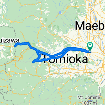
1142−1 まで甘楽町
A cycling route starting in Takasaki, Gunma, Japan.
Overview
About this route
- 1 h 38 min
- Duration
- 26.1 km
- Distance
- 431 m
- Ascent
- 274 m
- Descent
- 16 km/h
- Avg. speed
- 263 m
- Max. altitude
Route quality
Waytypes & surfaces along the route
Waytypes
Quiet road
21.6 km
(83 %)
Cycleway
2.1 km
(8 %)
Surfaces
Paved
1.8 km
(7 %)
Asphalt
1.6 km
(6 %)
Concrete
0.3 km
(1 %)
Undefined
24.2 km
(93 %)
Continue with Bikemap
Use, edit, or download this cycling route
You would like to ride 1142−1 まで甘楽町 or customize it for your own trip? Here is what you can do with this Bikemap route:
Free features
- Save this route as favorite or in collections
- Copy & plan your own version of this route
- Sync your route with Garmin or Wahoo
Premium features
Free trial for 3 days, or one-time payment. More about Bikemap Premium.
- Navigate this route on iOS & Android
- Export a GPX / KML file of this route
- Create your custom printout (try it for free)
- Download this route for offline navigation
Discover more Premium features.
Get Bikemap PremiumFrom our community
Other popular routes starting in Takasaki
 From Usui-Hill to Takasaki Via Mt.Myogi
- Distance
- 100.9 km
- Ascent
- 1,363 m
- Descent
- 1,361 m
- Location
- Takasaki, Gunma, Japan
 35-1, Takamatsucho, Takasaki to 1327, Minaminagano, Nagano
- Distance
- 132.4 km
- Ascent
- 2,395 m
- Descent
- 2,124 m
- Location
- Takasaki, Gunma, Japan
 Nancy Gray Day 1 Takasaki - Kusatsu
- Distance
- 76.2 km
- Ascent
- 2,038 m
- Descent
- 970 m
- Location
- Takasaki, Gunma, Japan
 767−2, 高崎市 まで渋川市
- Distance
- 18.7 km
- Ascent
- 141 m
- Descent
- 39 m
- Location
- Takasaki, Gunma, Japan
 2294-30, Yamanamachi, Takasaki to 2294-15, Yamanamachi, Takasaki
- Distance
- 12.1 km
- Ascent
- 95 m
- Descent
- 88 m
- Location
- Takasaki, Gunma, Japan
 Tour de Japon 7th Stage Takasaki - Nagano
- Distance
- 158.1 km
- Ascent
- 2,188 m
- Descent
- 1,920 m
- Location
- Takasaki, Gunma, Japan
 Takasaki Sta. to Karuizawa Sta.
- Distance
- 43.8 km
- Ascent
- 908 m
- Descent
- 72 m
- Location
- Takasaki, Gunma, Japan
 1142−1 まで甘楽町
- Distance
- 26.1 km
- Ascent
- 431 m
- Descent
- 274 m
- Location
- Takasaki, Gunma, Japan
Open it in the app