

Tour de West Ireland 2025 - dzień 1
A cycling route starting in Antrim, Northern Ireland, United Kingdom.
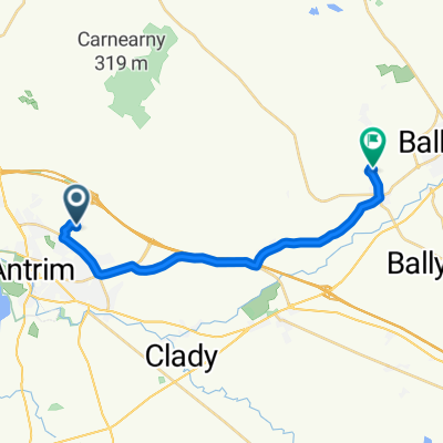
Overview
About this route
- 4 h 56 min
- Duration
- 84.8 km
- Distance
- 845 m
- Ascent
- 743 m
- Descent
- 17.2 km/h
- Avg. speed
- 435 m
- Max. altitude

Route quality
Waytypes & surfaces along the route
Waytypes
Quiet road
13.6 km
(16 %)
Road
12.7 km
(15 %)
Surfaces
Paved
40.7 km
(48 %)
Asphalt
40.7 km
(48 %)
Undefined
44.1 km
(52 %)
Continue with Bikemap
Use, edit, or download this cycling route
You would like to ride Tour de West Ireland 2025 - dzień 1 or customize it for your own trip? Here is what you can do with this Bikemap route:
Free features
- Save this route as favorite or in collections
- Copy & plan your own version of this route
- Split it into stages to create a multi-day tour
- Sync your route with Garmin or Wahoo
Premium features
Free trial for 3 days, or one-time payment. More about Bikemap Premium.
- Navigate this route on iOS & Android
- Export a GPX / KML file of this route
- Create your custom printout (try it for free)
- Download this route for offline navigation
Discover more Premium features.
Get Bikemap PremiumFrom our community
Other popular routes starting in Antrim
 Tour de West Ireland 2025 - dzień 1
- Distance
- 84.8 km
- Ascent
- 845 m
- Descent
- 743 m
- Location
- Antrim, Northern Ireland, United Kingdom
 3A Corbally Road, Crumlin to 22 Moneycarragh Road, Downpatrick
- Distance
- 62.5 km
- Ascent
- 560 m
- Descent
- 527 m
- Location
- Antrim, Northern Ireland, United Kingdom
 Trasa sobotnia
- Distance
- 80.7 km
- Ascent
- 300 m
- Descent
- 301 m
- Location
- Antrim, Northern Ireland, United Kingdom
 Noord Ierland
- Distance
- 733.3 km
- Ascent
- 1,850 m
- Descent
- 1,844 m
- Location
- Antrim, Northern Ireland, United Kingdom
 Ierland in de regen
- Distance
- 536 km
- Ascent
- 305 m
- Descent
- 355 m
- Location
- Antrim, Northern Ireland, United Kingdom
 Trasa na niedzielę
- Distance
- 51.5 km
- Ascent
- 306 m
- Descent
- 308 m
- Location
- Antrim, Northern Ireland, United Kingdom
 Menin Road 80 to Oriel Road 74
- Distance
- 16.7 km
- Ascent
- 145 m
- Descent
- 142 m
- Location
- Antrim, Northern Ireland, United Kingdom
 tues ride
- Distance
- 14.1 km
- Ascent
- 99 m
- Descent
- 100 m
- Location
- Antrim, Northern Ireland, United Kingdom
Open it in the app