

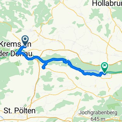
Retzer Straße to Hauptplatz
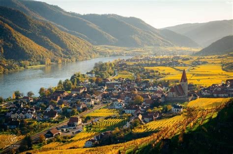
A cycling route starting in Krems, Lower Austria, Austria.
Overview
About this route
- 2 h 31 min
- Duration
- 42.1 km
- Distance
- 91 m
- Ascent
- 111 m
- Descent
- 16.8 km/h
- Avg. speed
- 202 m
- Max. altitude

Route quality
Waytypes & surfaces along the route
Waytypes
Track
26.1 km
(62 %)
Quiet road
6.3 km
(15 %)
Surfaces
Paved
41.2 km
(98 %)
Unpaved
0.4 km
(1 %)
Asphalt
41.2 km
(98 %)
Gravel
0.4 km
(1 %)
Undefined
0.4 km
(1 %)
Continue with Bikemap
Use, edit, or download this cycling route
You would like to ride Retzer Straße to Hauptplatz or customize it for your own trip? Here is what you can do with this Bikemap route:
Free features
- Save this route as favorite or in collections
- Copy & plan your own version of this route
- Sync your route with Garmin or Wahoo
Premium features
Free trial for 3 days, or one-time payment. More about Bikemap Premium.
- Navigate this route on iOS & Android
- Export a GPX / KML file of this route
- Create your custom printout (try it for free)
- Download this route for offline navigation
Discover more Premium features.
Get Bikemap PremiumFrom our community
Other popular routes starting in Krems
 Tag 1 - Senftenberg
- Distance
- 23.7 km
- Ascent
- 597 m
- Descent
- 595 m
- Location
- Krems, Lower Austria, Austria
 Obere Hauptstraße - Hauptplatz
- Distance
- 54.1 km
- Ascent
- 113 m
- Descent
- 126 m
- Location
- Krems, Lower Austria, Austria
 From Krems an der Donau to Bratislava
- Distance
- 162 km
- Ascent
- 608 m
- Descent
- 654 m
- Location
- Krems, Lower Austria, Austria
 Wachau túra harmadik nap
- Distance
- 42.1 km
- Ascent
- 91 m
- Descent
- 111 m
- Location
- Krems, Lower Austria, Austria
 Krems - Ardagger Markt
- Distance
- 88 km
- Ascent
- 509 m
- Descent
- 472 m
- Location
- Krems, Lower Austria, Austria
 Siedlungsgasse, Droß nach Siedlungsgasse, Droß
- Distance
- 15 km
- Ascent
- 45 m
- Descent
- 55 m
- Location
- Krems, Lower Austria, Austria
 Retzer Straße to Hauptplatz
- Distance
- 42.1 km
- Ascent
- 91 m
- Descent
- 111 m
- Location
- Krems, Lower Austria, Austria
 Krems - Pürbach Tour de Waldviertel
- Distance
- 76.6 km
- Ascent
- 787 m
- Descent
- 454 m
- Location
- Krems, Lower Austria, Austria
Open it in the app