

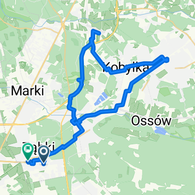
Untitled route
A cycling route starting in Ząbki, Masovian Voivodeship, Poland.
Overview
About this route
- 2 h 29 min
- Duration
- 36.8 km
- Distance
- 62 m
- Ascent
- 61 m
- Descent
- 14.8 km/h
- Avg. speed
- 94 m
- Max. altitude
Adam Zdrojewski

created this 6 months ago
Route quality
Waytypes & surfaces along the route
Waytypes
Quiet road
11 km
(30 %)
Cycleway
8.1 km
(22 %)
Surfaces
Paved
18.4 km
(50 %)
Unpaved
12.9 km
(35 %)
Asphalt
17.6 km
(48 %)
Unpaved (undefined)
5.9 km
(16 %)
Continue with Bikemap
Use, edit, or download this cycling route
You would like to ride Untitled route or customize it for your own trip? Here is what you can do with this Bikemap route:
Free features
- Save this route as favorite or in collections
- Copy & plan your own version of this route
- Sync your route with Garmin or Wahoo
Premium features
Free trial for 3 days, or one-time payment. More about Bikemap Premium.
- Navigate this route on iOS & Android
- Export a GPX / KML file of this route
- Create your custom printout (try it for free)
- Download this route for offline navigation
Discover more Premium features.
Get Bikemap PremiumFrom our community
Other popular routes starting in Ząbki
- Na rowerze 23 marzec 2023
- 14.2 km
- 193 m
- 194 m
- Ząbki, Masovian Voivodeship, Poland
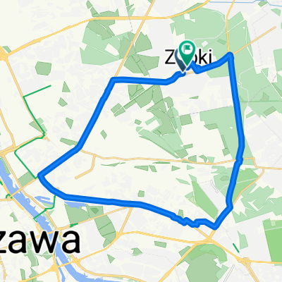
- Untitled route
- 36.8 km
- 62 m
- 61 m
- Ząbki, Masovian Voivodeship, Poland
- Różana do Warszawska 27B
- 34.2 km
- 43 m
- 47 m
- Ząbki, Masovian Voivodeship, Poland
- Trasa Wołomin/Ossów/Zagórze/🐱 Kotek
- 56.6 km
- 125 m
- 104 m
- Ząbki, Masovian Voivodeship, Poland
- Ks I Skorupki, Ząbki do Ks I Skorupki, Ząbki
- 24.8 km
- 183 m
- 186 m
- Ząbki, Masovian Voivodeship, Poland
- 01.11.2019
- 35.9 km
- 59 m
- 51 m
- Ząbki, Masovian Voivodeship, Poland


Open it in the app