Awakawa River trail to Akasaka
A cycling route starting in Kumagaya, Saitama, Japan.
Overview
About this route
- 4 h 41 min
- Duration
- 80.8 km
- Distance
- 373 m
- Ascent
- 371 m
- Descent
- 17.2 km/h
- Avg. speed
- 57 m
- Max. altitude
Route quality
Waytypes & surfaces along the route
Waytypes
Cycleway
51.7 km
(64 %)
Quiet road
20.2 km
(25 %)
Surfaces
Paved
21 km
(26 %)
Asphalt
16.2 km
(20 %)
Paved (undefined)
4.8 km
(6 %)
Undefined
59.8 km
(74 %)
Continue with Bikemap
Use, edit, or download this cycling route
You would like to ride Awakawa River trail to Akasaka or customize it for your own trip? Here is what you can do with this Bikemap route:
Free features
- Save this route as favorite or in collections
- Copy & plan your own version of this route
- Split it into stages to create a multi-day tour
- Sync your route with Garmin or Wahoo
Premium features
Free trial for 3 days, or one-time payment. More about Bikemap Premium.
- Navigate this route on iOS & Android
- Export a GPX / KML file of this route
- Create your custom printout (try it for free)
- Download this route for offline navigation
Discover more Premium features.
Get Bikemap PremiumFrom our community
Other popular routes starting in Kumagaya
- 118, Kamakuracho, Kumagaya to 10-9, Nakamaru 1-Chōme, Kitamoto
- Distance
- 22.4 km
- Ascent
- 68 m
- Descent
- 76 m
- Location
- Kumagaya, Saitama, Japan
- 112, Tsukuba 2-Chōme, Kumagaya to 118, Kamakuracho, Kumagaya
- Distance
- 1.3 km
- Ascent
- 4 m
- Descent
- 8 m
- Location
- Kumagaya, Saitama, Japan
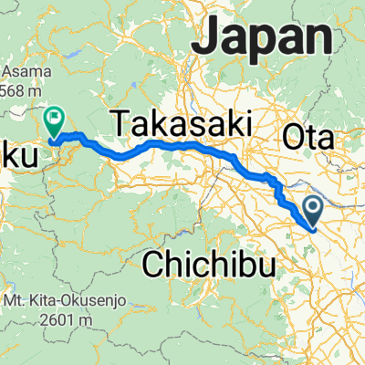
- 2-chōme, Kumagaya to Shim-Maebashi Station
- Distance
- 48.4 km
- Ascent
- 124 m
- Descent
- 48 m
- Location
- Kumagaya, Saitama, Japan
- Awakawa River trail to Akasaka
- Distance
- 80.8 km
- Ascent
- 373 m
- Descent
- 371 m
- Location
- Kumagaya, Saitama, Japan
- 3-chōme, Kumagaya to 2-chōme 28, Taito City
- Distance
- 75.8 km
- Ascent
- 335 m
- Descent
- 362 m
- Location
- Kumagaya, Saitama, Japan
- 1-chōme, Kumagaya to 宇都宮市
- Distance
- 93.6 km
- Ascent
- 1,005 m
- Descent
- 624 m
- Location
- Kumagaya, Saitama, Japan
- 210515 小川寄居里山ポタ
- Distance
- 70 km
- Ascent
- 688 m
- Descent
- 691 m
- Location
- Kumagaya, Saitama, Japan
- 2丁目, 熊谷市 to 1丁目 16, 練馬区
- Distance
- 65.3 km
- Ascent
- 315 m
- Descent
- 301 m
- Location
- Kumagaya, Saitama, Japan
Open it in the app