

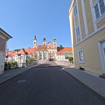
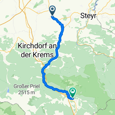
2025_05_21_Rohr-Traunbrücke-Kematen-Rohr
A cycling route starting in Bad Hall, Upper Austria, Austria.
Overview
About this route
- 3 h 25 min
- Duration
- 50.1 km
- Distance
- 535 m
- Ascent
- 533 m
- Descent
- 14.7 km/h
- Avg. speed
- 412 m
- Max. altitude

Route quality
Waytypes & surfaces along the route
Waytypes
Quiet road
33.6 km
(67 %)
Access road
8.5 km
(17 %)
Surfaces
Paved
9 km
(18 %)
Unpaved
4 km
(8 %)
Asphalt
9 km
(18 %)
Unpaved (undefined)
3.5 km
(7 %)
Continue with Bikemap
Use, edit, or download this cycling route
You would like to ride 2025_05_21_Rohr-Traunbrücke-Kematen-Rohr or customize it for your own trip? Here is what you can do with this Bikemap route:
Free features
- Save this route as favorite or in collections
- Copy & plan your own version of this route
- Sync your route with Garmin or Wahoo
Premium features
Free trial for 3 days, or one-time payment. More about Bikemap Premium.
- Navigate this route on iOS & Android
- Export a GPX / KML file of this route
- Create your custom printout (try it for free)
- Download this route for offline navigation
Discover more Premium features.
Get Bikemap PremiumFrom our community
Other popular routes starting in Bad Hall
 Stollen der Erinnerung, Steyr – Museumssteg Runde von Rohr-Bad Hall. 🚴🚴♂️
- Distance
- 65.9 km
- Ascent
- 606 m
- Descent
- 605 m
- Location
- Bad Hall, Upper Austria, Austria
 Steyrtalroute
- Distance
- 56.5 km
- Ascent
- 0 m
- Descent
- 0 m
- Location
- Bad Hall, Upper Austria, Austria
 Knackige Fahrt in Bad Hall
- Distance
- 53.8 km
- Ascent
- 943 m
- Descent
- 943 m
- Location
- Bad Hall, Upper Austria, Austria
 5 Flüsse Runde
- Distance
- 105.6 km
- Ascent
- 432 m
- Descent
- 426 m
- Location
- Bad Hall, Upper Austria, Austria
 353 Mostradler 19
- Distance
- 19.4 km
- Ascent
- 170 m
- Descent
- 170 m
- Location
- Bad Hall, Upper Austria, Austria
 Hintergebirge Goashansl Runde
- Distance
- 82.9 km
- Ascent
- 1,053 m
- Descent
- 1,051 m
- Location
- Bad Hall, Upper Austria, Austria
 Bad Hall - Design Center
- Distance
- 37.3 km
- Ascent
- 94 m
- Descent
- 217 m
- Location
- Bad Hall, Upper Austria, Austria
 Rohr Runde
- Distance
- 7.3 km
- Ascent
- 164 m
- Descent
- 174 m
- Location
- Bad Hall, Upper Austria, Austria
Open it in the app