
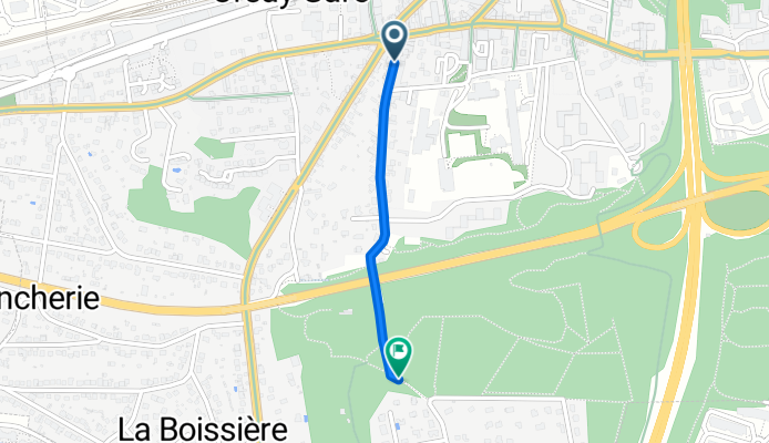
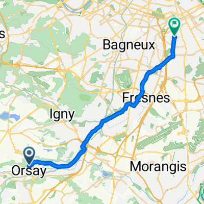
Rue Louis Scocard, Orsay à Le Clos des Cèdres, Orsay
A cycling route starting in Orsay, Île-de-France Region, France.
Overview
About this route
- 7 min
- Duration
- 1 km
- Distance
- 58 m
- Ascent
- 4 m
- Descent
- 8 km/h
- Avg. speed
- 152 m
- Max. altitude
Route quality
Waytypes & surfaces along the route
Waytypes
Quiet road
0.5 km
(54 %)
Track
0.3 km
(26 %)
Surfaces
Paved
0.7 km
(74 %)
Unpaved
0.3 km
(26 %)
Asphalt
0.7 km
(68 %)
Loose gravel
0.2 km
(20 %)
Continue with Bikemap
Use, edit, or download this cycling route
You would like to ride Rue Louis Scocard, Orsay à Le Clos des Cèdres, Orsay or customize it for your own trip? Here is what you can do with this Bikemap route:
Free features
- Save this route as favorite or in collections
- Copy & plan your own version of this route
- Sync your route with Garmin or Wahoo
Premium features
Free trial for 3 days, or one-time payment. More about Bikemap Premium.
- Navigate this route on iOS & Android
- Export a GPX / KML file of this route
- Create your custom printout (try it for free)
- Download this route for offline navigation
Discover more Premium features.
Get Bikemap PremiumFrom our community
Other popular routes starting in Orsay
 Orsay Paris
- Distance
- 30.1 km
- Ascent
- 156 m
- Descent
- 181 m
- Location
- Orsay, Île-de-France Region, France
 le Guichet - Safran CMH
- Distance
- 10.6 km
- Ascent
- 89 m
- Descent
- 8 m
- Location
- Orsay, Île-de-France Region, France
 Orsay VJ straight
- Distance
- 19.9 km
- Ascent
- 132 m
- Descent
- 117 m
- Location
- Orsay, Île-de-France Region, France
 Nord 1 S1
- Distance
- 33.7 km
- Ascent
- 206 m
- Descent
- 203 m
- Location
- Orsay, Île-de-France Region, France
 Orsay-Orsay
- Distance
- 11 km
- Ascent
- 149 m
- Descent
- 157 m
- Location
- Orsay, Île-de-France Region, France
 dimanche
- Distance
- 14.1 km
- Ascent
- 121 m
- Descent
- 124 m
- Location
- Orsay, Île-de-France Region, France
 Orsay - Rambouillet (Les étangs d'Hollande) Aller
- Distance
- 37.5 km
- Ascent
- 365 m
- Descent
- 247 m
- Location
- Orsay, Île-de-France Region, France
 UP and DOWN en Chevreuse
- Distance
- 75 km
- Ascent
- 564 m
- Descent
- 562 m
- Location
- Orsay, Île-de-France Region, France
Open it in the app