

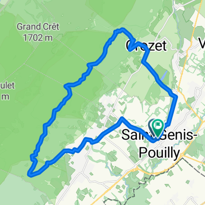
Thoiry up
A cycling route starting in Saint-Genis-Pouilly, Auvergne-Rhône-Alpes, France.
Overview
About this route
- 1 h 23 min
- Duration
- 9.6 km
- Distance
- 465 m
- Ascent
- 304 m
- Descent
- 6.9 km/h
- Avg. speed
- 902 m
- Max. altitude

Route quality
Waytypes & surfaces along the route
Waytypes
Quiet road
3.6 km
(38 %)
Path
2.9 km
(30 %)
Surfaces
Paved
3.7 km
(39 %)
Unpaved
2.6 km
(27 %)
Asphalt
3.7 km
(39 %)
Ground
1.9 km
(20 %)
Continue with Bikemap
Use, edit, or download this cycling route
You would like to ride Thoiry up or customize it for your own trip? Here is what you can do with this Bikemap route:
Free features
- Save this route as favorite or in collections
- Copy & plan your own version of this route
- Sync your route with Garmin or Wahoo
Premium features
Free trial for 3 days, or one-time payment. More about Bikemap Premium.
- Navigate this route on iOS & Android
- Export a GPX / KML file of this route
- Create your custom printout (try it for free)
- Download this route for offline navigation
Discover more Premium features.
Get Bikemap PremiumFrom our community
Other popular routes starting in Saint-Genis-Pouilly
 Fast ride in Saint-Genis-Pouilly
- Distance
- 24.2 km
- Ascent
- 644 m
- Descent
- 634 m
- Location
- Saint-Genis-Pouilly, Auvergne-Rhône-Alpes, France
 Motanie sa okolo Tiocan
- Distance
- 36.1 km
- Ascent
- 988 m
- Descent
- 987 m
- Location
- Saint-Genis-Pouilly, Auvergne-Rhône-Alpes, France
 Sergy medium - a/r
- Distance
- 21.6 km
- Ascent
- 177 m
- Descent
- 177 m
- Location
- Saint-Genis-Pouilly, Auvergne-Rhône-Alpes, France
 Pays de Gex 1.1
- Distance
- 40.3 km
- Ascent
- 348 m
- Descent
- 347 m
- Location
- Saint-Genis-Pouilly, Auvergne-Rhône-Alpes, France
 Tiocan and around #1
- Distance
- 38.2 km
- Ascent
- 1,437 m
- Descent
- 1,437 m
- Location
- Saint-Genis-Pouilly, Auvergne-Rhône-Alpes, France
 Allee des Ormes 32, Saint-Genis-Pouilly to Allee des Ormes 32, Saint-Genis-Pouilly
- Distance
- 24.5 km
- Ascent
- 215 m
- Descent
- 217 m
- Location
- Saint-Genis-Pouilly, Auvergne-Rhône-Alpes, France
 Saint Genis - Tiocan - Crozet - Saint Genis
- Distance
- 23.1 km
- Ascent
- 547 m
- Descent
- 540 m
- Location
- Saint-Genis-Pouilly, Auvergne-Rhône-Alpes, France
 St Genis circuit (short)
- Distance
- 20.9 km
- Ascent
- 206 m
- Descent
- 204 m
- Location
- Saint-Genis-Pouilly, Auvergne-Rhône-Alpes, France
Open it in the app