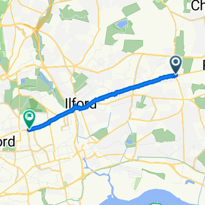
Route in Romford
A cycling route starting in Chadwell Heath, England, United Kingdom.
Overview
About this route
- 26 min
- Duration
- 7.4 km
- Distance
- 19 m
- Ascent
- 19 m
- Descent
- 17 km/h
- Avg. speed
- 27 m
- Avg. speed
Route quality
Waytypes & surfaces along the route
Waytypes
Quiet road
5 km
(68 %)
Road
1.1 km
(15 %)
Surfaces
Paved
0.4 km
(6 %)
Asphalt
0.4 km
(6 %)
Undefined
7 km
(94 %)
Continue with Bikemap
Use, edit, or download this cycling route
You would like to ride Route in Romford or customize it for your own trip? Here is what you can do with this Bikemap route:
Free features
- Save this route as favorite or in collections
- Copy & plan your own version of this route
- Sync your route with Garmin or Wahoo
Premium features
Free trial for 3 days, or one-time payment. More about Bikemap Premium.
- Navigate this route on iOS & Android
- Export a GPX / KML file of this route
- Create your custom printout (try it for free)
- Download this route for offline navigation
Discover more Premium features.
Get Bikemap PremiumFrom our community
Other popular routes starting in Chadwell Heath
- Restful route in Purfleet
- Distance
- 19.2 km
- Ascent
- 18 m
- Descent
- 31 m
- Location
- Chadwell Heath, England, United Kingdom
- London to Southend-on-Sea
- Distance
- 59.1 km
- Ascent
- 364 m
- Descent
- 352 m
- Location
- Chadwell Heath, England, United Kingdom
- fsdafdasfsafas
- Distance
- 82.5 km
- Ascent
- 394 m
- Descent
- 394 m
- Location
- Chadwell Heath, England, United Kingdom
- Essex Long 75 miles route from Goodmayes
- Distance
- 120.9 km
- Ascent
- 784 m
- Descent
- 783 m
- Location
- Chadwell Heath, England, United Kingdom
- Lee Avenue 24, Dagenham to Hainault Health Centre (Stop U), Ilford
- Distance
- 6.1 km
- Ascent
- 47 m
- Descent
- 34 m
- Location
- Chadwell Heath, England, United Kingdom
- To Stratford
- Distance
- 11.1 km
- Ascent
- 63 m
- Descent
- 73 m
- Location
- Chadwell Heath, England, United Kingdom
- 51.57051272917455, 0.10383590310766323 to 51.539357313820325, 0.0811786524853278
- Distance
- 5.2 km
- Ascent
- 0 m
- Descent
- 9 m
- Location
- Chadwell Heath, England, United Kingdom
- Climate emergency centre Goodmayes to Eastbrookend and the Chase nature reserve
- Distance
- 15.7 km
- Ascent
- 16 m
- Descent
- 15 m
- Location
- Chadwell Heath, England, United Kingdom
Open it in the app