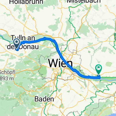
Tulln bis Neusiedl
A cycling route starting in Langenrohr, Lower Austria, Austria.
Overview
About this route
- 5 h 48 min
- Duration
- 103.9 km
- Distance
- 434 m
- Ascent
- 493 m
- Descent
- 17.9 km/h
- Avg. speed
- 219 m
- Avg. speed
Route quality
Waytypes & surfaces along the route
Waytypes
Cycleway
37.2 km
(36 %)
Track
30.9 km
(30 %)
Surfaces
Paved
99.6 km
(96 %)
Unpaved
2.5 km
(2 %)
Asphalt
98.5 km
(95 %)
Gravel
2.5 km
(2 %)
Continue with Bikemap
Use, edit, or download this cycling route
You would like to ride Tulln bis Neusiedl or customize it for your own trip? Here is what you can do with this Bikemap route:
Free features
- Save this route as favorite or in collections
- Copy & plan your own version of this route
- Sync your route with Garmin or Wahoo
Premium features
Free trial for 3 days, or one-time payment. More about Bikemap Premium.
- Navigate this route on iOS & Android
- Export a GPX / KML file of this route
- Create your custom printout (try it for free)
- Download this route for offline navigation
Discover more Premium features.
Get Bikemap PremiumFrom our community
Other popular routes starting in Langenrohr
- Tulln bis Neusiedl
- Distance
- 103.9 km
- Ascent
- 434 m
- Descent
- 493 m
- Location
- Langenrohr, Lower Austria, Austria
- Z03 Tulln - Krems
- Distance
- 76.7 km
- Ascent
- 228 m
- Descent
- 206 m
- Location
- Langenrohr, Lower Austria, Austria
- Tulln Hotel Tullnerfeld, - Obersdorf
- Distance
- 44.6 km
- Ascent
- 156 m
- Descent
- 160 m
- Location
- Langenrohr, Lower Austria, Austria
- Tulln-Klausen Leopoldsdorf-Laaben Tulln
- Distance
- 104.9 km
- Ascent
- 884 m
- Descent
- 860 m
- Location
- Langenrohr, Lower Austria, Austria
- Bahnhofsring 48, Michelhausen nach Am Hafen 4–16, Traismauer
- Distance
- 29.4 km
- Ascent
- 72 m
- Descent
- 63 m
- Location
- Langenrohr, Lower Austria, Austria
- L2090 to Hauptallee W, Wien
- Distance
- 48.7 km
- Ascent
- 90 m
- Descent
- 173 m
- Location
- Langenrohr, Lower Austria, Austria
- tulln bhf _kamptal _geras _drosendf _hardegg _pulkau __retz plng
- Distance
- 160.4 km
- Ascent
- 716 m
- Descent
- 629 m
- Location
- Langenrohr, Lower Austria, Austria
- Tulln bis Rust
- Distance
- 121.2 km
- Ascent
- 541 m
- Descent
- 594 m
- Location
- Langenrohr, Lower Austria, Austria
Open it in the app