

안정적인 라이딩
A cycling route starting in Busan, Busan, South Korea.
Overview
About this route
- 4 h 18 min
- Duration
- 50.1 km
- Distance
- 1,090 m
- Ascent
- 1,131 m
- Descent
- 11.6 km/h
- Avg. speed
- 269 m
- Max. altitude
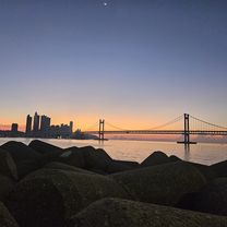
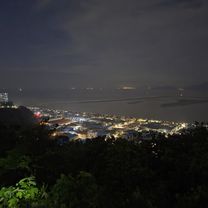
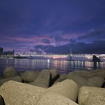
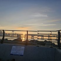
Route photos


Continue with Bikemap
Use, edit, or download this cycling route
You would like to ride 안정적인 라이딩 or customize it for your own trip? Here is what you can do with this Bikemap route:
Free features
- Save this route as favorite or in collections
- Copy & plan your own version of this route
- Sync your route with Garmin or Wahoo
Premium features
Free trial for 3 days, or one-time payment. More about Bikemap Premium.
- Navigate this route on iOS & Android
- Export a GPX / KML file of this route
- Create your custom printout (try it for free)
- Download this route for offline navigation
Discover more Premium features.
Get Bikemap PremiumFrom our community
Other popular routes starting in Busan
 2025.8.20
- Distance
- 20.9 km
- Ascent
- 46 m
- Descent
- 40 m
- Location
- Busan, Busan, South Korea
 집 수영강 회동저수지 입구
- Distance
- 34.4 km
- Ascent
- 121 m
- Descent
- 192 m
- Location
- Busan, Busan, South Korea
 괘법동, 부산광역시에서 낙동남로1233번길, 부산광역시까지
- Distance
- 6.9 km
- Ascent
- 10 m
- Descent
- 21 m
- Location
- Busan, Busan, South Korea
 2025.8.26 03:15~06:35 수영천 온천천 55킬로
- Distance
- 55.2 km
- Ascent
- 205 m
- Descent
- 253 m
- Location
- Busan, Busan, South Korea
![Ph0]에서 경로용호제1동 179-9](https://www.bikemap.net/media/temp/routes_gallery/51dd4d70-ba53-488f-a543-b90a6398e0fe.jpg) Ph0]에서 경로용호제1동 179-9
Ph0]에서 경로용호제1동 179-9- Distance
- 25.1 km
- Ascent
- 63 m
- Descent
- 142 m
- Location
- Busan, Busan, South Korea
 다대포 아미산
- Distance
- 23.4 km
- Ascent
- 211 m
- Descent
- 238 m
- Location
- Busan, Busan, South Korea
 2025.9.25 수영천왕복
- Distance
- 33.4 km
- Ascent
- 150 m
- Descent
- 98 m
- Location
- Busan, Busan, South Korea
 2025.8.11 3시45분 6시50분 집 수영강 회동저수지 입구
- Distance
- 34.4 km
- Ascent
- 121 m
- Descent
- 192 m
- Location
- Busan, Busan, South Korea
Open it in the app