

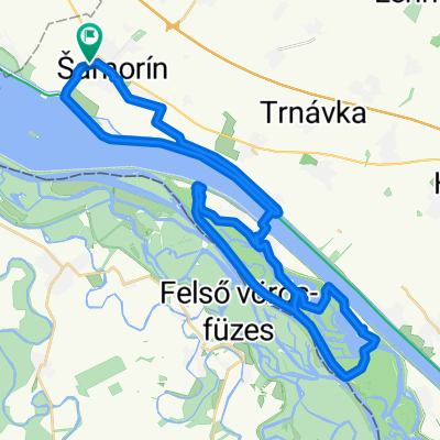
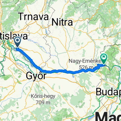
Route to Bratislava
A cycling route starting in Šamorín, Trnava Region, Slovakia.
Overview
About this route
- 1 h 28 min
- Duration
- 26.8 km
- Distance
- 51 m
- Ascent
- 37 m
- Descent
- 18.2 km/h
- Avg. speed
- 142 m
- Max. altitude

Route quality
Waytypes & surfaces along the route
Waytypes
Cycleway
22.5 km
(84 %)
Quiet road
2.7 km
(10 %)
Surfaces
Paved
24.6 km
(92 %)
Asphalt
24.4 km
(91 %)
Concrete
0.3 km
(1 %)
Undefined
2.1 km
(8 %)
Continue with Bikemap
Use, edit, or download this cycling route
You would like to ride Route to Bratislava or customize it for your own trip? Here is what you can do with this Bikemap route:
Free features
- Save this route as favorite or in collections
- Copy & plan your own version of this route
- Sync your route with Garmin or Wahoo
Premium features
Free trial for 3 days, or one-time payment. More about Bikemap Premium.
- Navigate this route on iOS & Android
- Export a GPX / KML file of this route
- Create your custom printout (try it for free)
- Download this route for offline navigation
Discover more Premium features.
Get Bikemap PremiumFrom our community
Other popular routes starting in Šamorín
 Rohovce, Rohovce to Hodžovo nám, Bratislava I
- Distance
- 37.4 km
- Ascent
- 47 m
- Descent
- 10 m
- Location
- Šamorín, Trnava Region, Slovakia
 Ulica Márie do Ulica Márie
- Distance
- 15.8 km
- Ascent
- 29 m
- Descent
- 79 m
- Location
- Šamorín, Trnava Region, Slovakia
 Cilistov - Gabcikovo - Vojka - Cilistov
- Distance
- 49.2 km
- Ascent
- 44 m
- Descent
- 43 m
- Location
- Šamorín, Trnava Region, Slovakia
 Šamorín Čilistov X-BIONIC SPHERE-Horný Bar-Jurová-Vrakuň-Hotel Amade Chateau
- Distance
- 32.3 km
- Ascent
- 31 m
- Descent
- 40 m
- Location
- Šamorín, Trnava Region, Slovakia
 2014_Slovakia_Danube_Šamorin_Vojka nad Dunajom
- Distance
- 46.2 km
- Ascent
- 23 m
- Descent
- 21 m
- Location
- Šamorín, Trnava Region, Slovakia
 Šamorín_ Vojka nad Dunajom_Šamorín
- Distance
- 46.2 km
- Ascent
- 51 m
- Descent
- 49 m
- Location
- Šamorín, Trnava Region, Slovakia
 Etappe 7
- Distance
- 145.6 km
- Ascent
- 178 m
- Descent
- 190 m
- Location
- Šamorín, Trnava Region, Slovakia
 Kyselica do Kyselica
- Distance
- 27.9 km
- Ascent
- 88 m
- Descent
- 74 m
- Location
- Šamorín, Trnava Region, Slovakia
Open it in the app