Oishi, Fujikawaguchiko to Ikebukuro 2-Chōme, Toshima
A cycling route starting in Fujikawaguchiko, Yamanashi, Japan.
Overview
About this route
- 9 h 52 min
- Duration
- 142.8 km
- Distance
- 1,093 m
- Ascent
- 1,901 m
- Descent
- 14.5 km/h
- Avg. speed
- 946 m
- Max. altitude
Continue with Bikemap
Use, edit, or download this cycling route
You would like to ride Oishi, Fujikawaguchiko to Ikebukuro 2-Chōme, Toshima or customize it for your own trip? Here is what you can do with this Bikemap route:
Free features
- Save this route as favorite or in collections
- Copy & plan your own version of this route
- Split it into stages to create a multi-day tour
- Sync your route with Garmin or Wahoo
Premium features
Free trial for 3 days, or one-time payment. More about Bikemap Premium.
- Navigate this route on iOS & Android
- Export a GPX / KML file of this route
- Create your custom printout (try it for free)
- Download this route for offline navigation
Discover more Premium features.
Get Bikemap PremiumFrom our community
Other popular routes starting in Fujikawaguchiko
3-chōme to 3-chōme- Distance
- 116.1 km
- Ascent
- 2,470 m
- Descent
- 3,236 m
- Location
- Fujikawaguchiko, Yamanashi, Japan
Oishi, Fujikawaguchiko to Ikebukuro 2-Chōme, Toshima- Distance
- 142.8 km
- Ascent
- 1,093 m
- Descent
- 1,901 m
- Location
- Fujikawaguchiko, Yamanashi, Japan
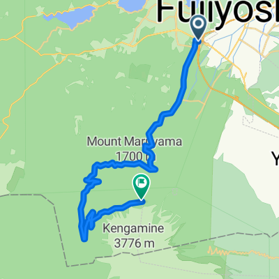
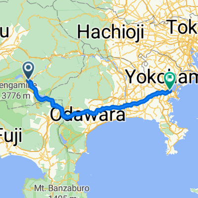
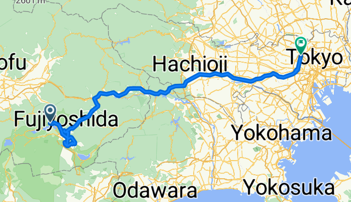
Fujikawaguchiko - Fujikawaguchiko- Distance
- 33.7 km
- Ascent
- 213 m
- Descent
- 224 m
- Location
- Fujikawaguchiko, Yamanashi, Japan
「Day 3 北進富士山」的起點 - Day 3 北進富士山終點 - Day 3 北進富士山- Distance
- 25.4 km
- Ascent
- 1,419 m
- Descent
- 122 m
- Location
- Fujikawaguchiko, Yamanashi, Japan
MYSTAYS 富士山展望温泉酒店 to Fujiyoshida- Distance
- 75.7 km
- Ascent
- 2,460 m
- Descent
- 2,462 m
- Location
- Fujikawaguchiko, Yamanashi, Japan
Fuji 上山日- Distance
- 28.4 km
- Ascent
- 1,436 m
- Descent
- 22 m
- Location
- Fujikawaguchiko, Yamanashi, Japan
Route in Nagoya- Distance
- 58.6 km
- Ascent
- 1,674 m
- Descent
- 1,712 m
- Location
- Fujikawaguchiko, Yamanashi, Japan
Megu to Yamanaka- Distance
- 45.4 km
- Ascent
- 639 m
- Descent
- 595 m
- Location
- Fujikawaguchiko, Yamanashi, Japan
Open it in the app


