

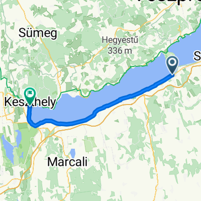
Vak Bottyán utca, Balatonföldvár - Helikonliget, Keszthely
A cycling route starting in Balatonföldvár, Somogy County, Hungary.
Overview
About this route
- 2 h 19 min
- Duration
- 63 km
- Distance
- 122 m
- Ascent
- 124 m
- Descent
- 27.2 km/h
- Avg. speed
- 122 m
- Max. altitude

Route quality
Waytypes & surfaces along the route
Waytypes
Living street
25.1 km
(40 %)
Cycleway
19.9 km
(32 %)
Surfaces
Paved
62.4 km
(99 %)
Asphalt
61.1 km
(97 %)
Paving stones
1.2 km
(2 %)
Continue with Bikemap
Use, edit, or download this cycling route
You would like to ride Vak Bottyán utca, Balatonföldvár - Helikonliget, Keszthely or customize it for your own trip? Here is what you can do with this Bikemap route:
Free features
- Save this route as favorite or in collections
- Copy & plan your own version of this route
- Sync your route with Garmin or Wahoo
Premium features
Free trial for 3 days, or one-time payment. More about Bikemap Premium.
- Navigate this route on iOS & Android
- Export a GPX / KML file of this route
- Create your custom printout (try it for free)
- Download this route for offline navigation
Discover more Premium features.
Get Bikemap PremiumFrom our community
Other popular routes starting in Balatonföldvár
 Balatoni kör 2 nap
- Distance
- 82.6 km
- Ascent
- 163 m
- Descent
- 165 m
- Location
- Balatonföldvár, Somogy County, Hungary
 Balatoni kör 3 nap
- Distance
- 55.1 km
- Ascent
- 71 m
- Descent
- 64 m
- Location
- Balatonföldvár, Somogy County, Hungary
 Vak Bottyán utca, Balatonföldvár - Helikonliget, Keszthely
- Distance
- 63 km
- Ascent
- 122 m
- Descent
- 124 m
- Location
- Balatonföldvár, Somogy County, Hungary
 Zrínyi utca 8, Szántód - Zrínyi utca 6, Szántód
- Distance
- 65.8 km
- Ascent
- 503 m
- Descent
- 455 m
- Location
- Balatonföldvár, Somogy County, Hungary
 Alternatív Balatonkör
- Distance
- 97.2 km
- Ascent
- 275 m
- Descent
- 272 m
- Location
- Balatonföldvár, Somogy County, Hungary
 Balaton félkör Keszthely felé
- Distance
- 143.7 km
- Ascent
- 150 m
- Descent
- 150 m
- Location
- Balatonföldvár, Somogy County, Hungary
 Gasztro route to Siófok 💪
- Distance
- 12.5 km
- Ascent
- 17 m
- Descent
- 18 m
- Location
- Balatonföldvár, Somogy County, Hungary
 Lengthy ride through Szántód
- Distance
- 199.7 km
- Ascent
- 190 m
- Descent
- 188 m
- Location
- Balatonföldvár, Somogy County, Hungary
Open it in the app