

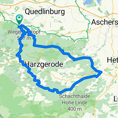
Karl-Marx-Straße, Thale nach Karl-Marx-Straße, Thale
A cycling route starting in Thale, Saxony-Anhalt, Germany.
Overview
About this route
- 1 h 21 min
- Duration
- 30.3 km
- Distance
- 256 m
- Ascent
- 253 m
- Descent
- 22.3 km/h
- Avg. speed
- 241 m
- Max. altitude

Route quality
Waytypes & surfaces along the route
Waytypes
Path
8.5 km
(28 %)
Quiet road
7.9 km
(26 %)
Surfaces
Paved
19.4 km
(64 %)
Unpaved
7.9 km
(26 %)
Asphalt
19.1 km
(63 %)
Gravel
3 km
(10 %)
Continue with Bikemap
Use, edit, or download this cycling route
You would like to ride Karl-Marx-Straße, Thale nach Karl-Marx-Straße, Thale or customize it for your own trip? Here is what you can do with this Bikemap route:
Free features
- Save this route as favorite or in collections
- Copy & plan your own version of this route
- Sync your route with Garmin or Wahoo
Premium features
Free trial for 3 days, or one-time payment. More about Bikemap Premium.
- Navigate this route on iOS & Android
- Export a GPX / KML file of this route
- Create your custom printout (try it for free)
- Download this route for offline navigation
Discover more Premium features.
Get Bikemap PremiumFrom our community
Other popular routes starting in Thale
 Connis Route
- Distance
- 38.7 km
- Ascent
- 812 m
- Descent
- 812 m
- Location
- Thale, Saxony-Anhalt, Germany
 Thale _ Braunlage
- Distance
- 105.4 km
- Ascent
- 1,187 m
- Descent
- 1,187 m
- Location
- Thale, Saxony-Anhalt, Germany
 Trainingslager Thale 2013
- Distance
- 125.2 km
- Ascent
- 1,586 m
- Descent
- 1,586 m
- Location
- Thale, Saxony-Anhalt, Germany
 Thale Rundkurs
- Distance
- 25.8 km
- Ascent
- 568 m
- Descent
- 554 m
- Location
- Thale, Saxony-Anhalt, Germany
 2. Tag Thale-Rübeland
- Distance
- 73.9 km
- Ascent
- 1,181 m
- Descent
- 1,073 m
- Location
- Thale, Saxony-Anhalt, Germany
 97 1610 Thale Biesen Wippra FBR
- Distance
- 96.7 km
- Ascent
- 1,148 m
- Descent
- 1,145 m
- Location
- Thale, Saxony-Anhalt, Germany
 Thale: Rübchen und Steinköpfe
- Distance
- 14 km
- Ascent
- 296 m
- Descent
- 296 m
- Location
- Thale, Saxony-Anhalt, Germany
 vom Harz zum Rennsteig -Entwurf
- Distance
- 195.2 km
- Ascent
- 1,850 m
- Descent
- 1,829 m
- Location
- Thale, Saxony-Anhalt, Germany
Open it in the app