

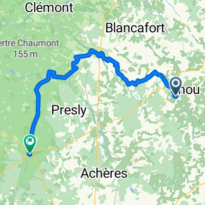
Assigny-Chabris
A cycling route starting in Savigny-en-Sancerre, Centre-Val de Loire, France.
Overview
About this route
- 11 h 49 min
- Duration
- 187.9 km
- Distance
- 562 m
- Ascent
- 761 m
- Descent
- 15.9 km/h
- Avg. speed
- 318 m
- Max. altitude
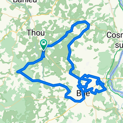
Route quality
Waytypes & surfaces along the route
Waytypes
Quiet road
52.6 km
(28 %)
Path
48.9 km
(26 %)
Surfaces
Paved
75.2 km
(40 %)
Unpaved
7.5 km
(4 %)
Asphalt
75.2 km
(40 %)
Ground
3.8 km
(2 %)
Continue with Bikemap
Use, edit, or download this cycling route
You would like to ride Assigny-Chabris or customize it for your own trip? Here is what you can do with this Bikemap route:
Free features
- Save this route as favorite or in collections
- Copy & plan your own version of this route
- Split it into stages to create a multi-day tour
- Sync your route with Garmin or Wahoo
Premium features
Free trial for 3 days, or one-time payment. More about Bikemap Premium.
- Navigate this route on iOS & Android
- Export a GPX / KML file of this route
- Create your custom printout (try it for free)
- Download this route for offline navigation
Discover more Premium features.
Get Bikemap PremiumFrom our community
Other popular routes starting in Savigny-en-Sancerre
 Vailly sur Sauldre
- Distance
- 79.6 km
- Ascent
- 885 m
- Descent
- 885 m
- Location
- Savigny-en-Sancerre, Centre-Val de Loire, France
 Savigny-en-Sancerre - Neuvy-sur-Barangeon
- Distance
- 60 km
- Ascent
- 277 m
- Descent
- 359 m
- Location
- Savigny-en-Sancerre, Centre-Val de Loire, France
 Day 1
Day 1- Distance
- 79.3 km
- Ascent
- 276 m
- Descent
- 351 m
- Location
- Savigny-en-Sancerre, Centre-Val de Loire, France
 Assigny-Chabris
- Distance
- 187.9 km
- Ascent
- 562 m
- Descent
- 761 m
- Location
- Savigny-en-Sancerre, Centre-Val de Loire, France
 Jars-Sancerre 87 km
- Distance
- 87 km
- Ascent
- 1,536 m
- Descent
- 1,536 m
- Location
- Savigny-en-Sancerre, Centre-Val de Loire, France
 Tour_Laufenburg - Le Croisic_Etappe4
- Distance
- 158.2 km
- Ascent
- 218 m
- Descent
- 427 m
- Location
- Savigny-en-Sancerre, Centre-Val de Loire, France
 De La Vallée, Savigny-en-Sancerre à Route de Sury Près Léré, Savigny-en-Sancerre
- Distance
- 2.6 km
- Ascent
- 23 m
- Descent
- 27 m
- Location
- Savigny-en-Sancerre, Centre-Val de Loire, France
 Ste Gemme - Lere - Sancerre #2
- Distance
- 66.7 km
- Ascent
- 434 m
- Descent
- 434 m
- Location
- Savigny-en-Sancerre, Centre-Val de Loire, France
Open it in the app