

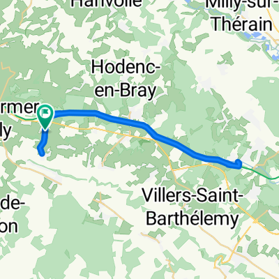
Jour 2 (2/2) : St-Germer-de-Fly / Forges-les-Eaux
A cycling route starting in Saint-Germer-de-Fly, Hauts-de-France, France.
Overview
About this route
- 1 h 52 min
- Duration
- 33.1 km
- Distance
- 316 m
- Ascent
- 253 m
- Descent
- 17.7 km/h
- Avg. speed
- 195 m
- Max. altitude
Route quality
Waytypes & surfaces along the route
Waytypes
Road
14.2 km
(43 %)
Quiet road
11.6 km
(35 %)
Surfaces
Paved
11.9 km
(36 %)
Asphalt
11.9 km
(36 %)
Undefined
21.2 km
(64 %)
Continue with Bikemap
Use, edit, or download this cycling route
You would like to ride Jour 2 (2/2) : St-Germer-de-Fly / Forges-les-Eaux or customize it for your own trip? Here is what you can do with this Bikemap route:
Free features
- Save this route as favorite or in collections
- Copy & plan your own version of this route
- Sync your route with Garmin or Wahoo
Premium features
Free trial for 3 days, or one-time payment. More about Bikemap Premium.
- Navigate this route on iOS & Android
- Export a GPX / KML file of this route
- Create your custom printout (try it for free)
- Download this route for offline navigation
Discover more Premium features.
Get Bikemap PremiumFrom our community
Other popular routes starting in Saint-Germer-de-Fly
 Jour 2 (2/2) : St-Germer-de-Fly / Forges-les-Eaux
- Distance
- 33.1 km
- Ascent
- 316 m
- Descent
- 253 m
- Location
- Saint-Germer-de-Fly, Hauts-de-France, France
 9 Rue de la Briqueterie, Cuigy-en-Bray à D 931, Saint-Paul
- Distance
- 11.6 km
- Ascent
- 24 m
- Descent
- 43 m
- Location
- Saint-Germer-de-Fly, Hauts-de-France, France
 Paris Teil 1 bis Cergy
- Distance
- 92.3 km
- Ascent
- 705 m
- Descent
- 768 m
- Location
- Saint-Germer-de-Fly, Hauts-de-France, France
 AV-J2 Gisors / St Germer de Fly
- Distance
- 29.5 km
- Ascent
- 220 m
- Descent
- 252 m
- Location
- Saint-Germer-de-Fly, Hauts-de-France, France
 L2016 - Gournay-Dieppe
- Distance
- 93.9 km
- Ascent
- 246 m
- Descent
- 339 m
- Location
- Saint-Germer-de-Fly, Hauts-de-France, France
 Etape5-st-germer-de-fly-forges-les-eaux
- Distance
- 32.8 km
- Ascent
- 277 m
- Descent
- 207 m
- Location
- Saint-Germer-de-Fly, Hauts-de-France, France
 Route d'Orsimont 1, Saint-Germer-de-Fly to Rue de la République 2, Forges-les-Eaux
- Distance
- 32.7 km
- Ascent
- 434 m
- Descent
- 364 m
- Location
- Saint-Germer-de-Fly, Hauts-de-France, France
 De Rue des Solons 34, Cuigy-en-Bray à Rue des Solons 34, Cuigy-en-Bray
- Distance
- 112.1 km
- Ascent
- 16 m
- Descent
- 31 m
- Location
- Saint-Germer-de-Fly, Hauts-de-France, France
Open it in the app