

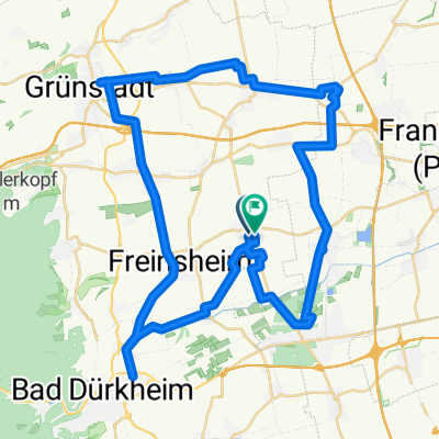
Route in Weisenheim am Sand
A cycling route starting in Weisenheim am Sand, Rhineland-Palatinate, Germany.
Overview
About this route
- 50 h 31 min
- Duration
- 828.1 km
- Distance
- 9,896 m
- Ascent
- 9,898 m
- Descent
- 16.4 km/h
- Avg. speed
- 671 m
- Max. altitude

Route quality
Waytypes & surfaces along the route
Waytypes
Path
307.9 km
(37 %)
Track
227 km
(27 %)
Surfaces
Paved
671.6 km
(81 %)
Unpaved
58.4 km
(7 %)
Asphalt
596.7 km
(72 %)
Paved (undefined)
64.8 km
(8 %)
Continue with Bikemap
Use, edit, or download this cycling route
You would like to ride Route in Weisenheim am Sand or customize it for your own trip? Here is what you can do with this Bikemap route:
Free features
- Save this route as favorite or in collections
- Copy & plan your own version of this route
- Split it into stages to create a multi-day tour
- Sync your route with Garmin or Wahoo
Premium features
Free trial for 3 days, or one-time payment. More about Bikemap Premium.
- Navigate this route on iOS & Android
- Export a GPX / KML file of this route
- Create your custom printout (try it for free)
- Download this route for offline navigation
Discover more Premium features.
Get Bikemap PremiumFrom our community
Other popular routes starting in Weisenheim am Sand
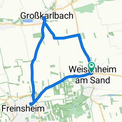
 Speyerer Straße 13, Weisenheim am Berg nach Hanns-Fay-Straße 3, Frankenthal
- Distance
- 9.4 km
- Ascent
- 7 m
- Descent
- 11 m
- Location
- Weisenheim am Sand, Rhineland-Palatinate, Germany
 Route in Weisenheim am Sand
- Distance
- 828.1 km
- Ascent
- 9,896 m
- Descent
- 9,898 m
- Location
- Weisenheim am Sand, Rhineland-Palatinate, Germany
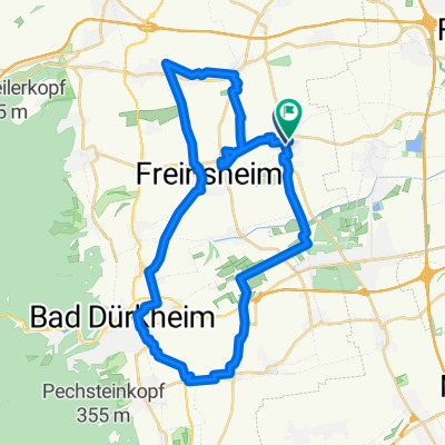
 Ziegelhütte 13, Weisenheim am Berg nach Straße ohne Straßennamen, Weisenheim am Berg
- Distance
- 13.9 km
- Ascent
- 357 m
- Descent
- 70 m
- Location
- Weisenheim am Sand, Rhineland-Palatinate, Germany
 unsere 1 route werner ursula
- Distance
- 547.9 km
- Ascent
- 61 m
- Descent
- 172 m
- Location
- Weisenheim am Sand, Rhineland-Palatinate, Germany
 L454 nach Ostring
- Distance
- 51.2 km
- Ascent
- 220 m
- Descent
- 220 m
- Location
- Weisenheim am Sand, Rhineland-Palatinate, Germany
 Ostring nach Ostring
- Distance
- 10.5 km
- Ascent
- 77 m
- Descent
- 75 m
- Location
- Weisenheim am Sand, Rhineland-Palatinate, Germany
 kleine Runde Rainer
- Distance
- 36 km
- Ascent
- 203 m
- Descent
- 203 m
- Location
- Weisenheim am Sand, Rhineland-Palatinate, Germany
 Tag 1 - Weisenheim nach Bad Wimpfen
- Distance
- 120.2 km
- Ascent
- 315 m
- Descent
- 242 m
- Location
- Weisenheim am Sand, Rhineland-Palatinate, Germany
Open it in the app