

four Champagne Villiges
A cycling route starting in Sillery, Grand Est, France.
Overview
About this route
- 2 h 18 min
- Duration
- 34.3 km
- Distance
- 339 m
- Ascent
- 340 m
- Descent
- 15 km/h
- Avg. speed
- 213 m
- Max. altitude

Route quality
Waytypes & surfaces along the route
Waytypes
Quiet road
15.1 km
(44 %)
Track
7.5 km
(22 %)
Surfaces
Paved
10 km
(29 %)
Unpaved
1.7 km
(5 %)
Asphalt
10 km
(29 %)
Unpaved (undefined)
0.7 km
(2 %)
Continue with Bikemap
Use, edit, or download this cycling route
You would like to ride four Champagne Villiges or customize it for your own trip? Here is what you can do with this Bikemap route:
Free features
- Save this route as favorite or in collections
- Copy & plan your own version of this route
- Sync your route with Garmin or Wahoo
Premium features
Free trial for 3 days, or one-time payment. More about Bikemap Premium.
- Navigate this route on iOS & Android
- Export a GPX / KML file of this route
- Create your custom printout (try it for free)
- Download this route for offline navigation
Discover more Premium features.
Get Bikemap PremiumFrom our community
Other popular routes starting in Sillery
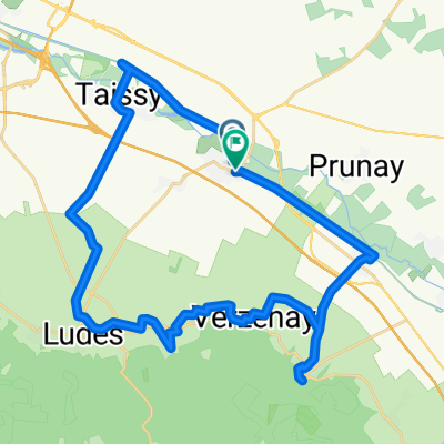 four Champagne Villiges
- Distance
- 34.3 km
- Ascent
- 339 m
- Descent
- 340 m
- Location
- Sillery, Grand Est, France
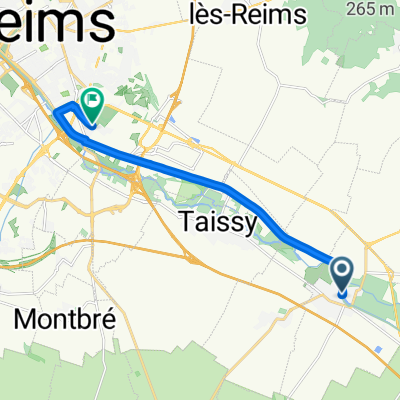 Rue Jacques Cartier, Sillery nach Reims
- Distance
- 10.6 km
- Ascent
- 31 m
- Descent
- 20 m
- Location
- Sillery, Grand Est, France
 Une petite boucle au pied de la Montagne de Reims
- Distance
- 28.6 km
- Ascent
- 134 m
- Descent
- 135 m
- Location
- Sillery, Grand Est, France
 Une petite boucle au pied de la Montagne de Reims
- Distance
- 28.6 km
- Ascent
- 111 m
- Descent
- 110 m
- Location
- Sillery, Grand Est, France
 montagne par trepail
- Distance
- 94.4 km
- Ascent
- 757 m
- Descent
- 756 m
- Location
- Sillery, Grand Est, France
 De Autoroute de l'Est à Avenue François Mitterrand
- Distance
- 12.3 km
- Ascent
- 33 m
- Descent
- 99 m
- Location
- Sillery, Grand Est, France
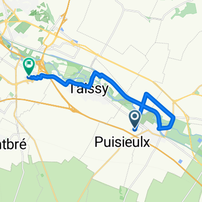
 B07 Puisieulx - Chalon en Champagne
- Distance
- 49.5 km
- Ascent
- 95 m
- Descent
- 100 m
- Location
- Sillery, Grand Est, France
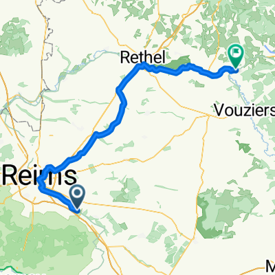 Sillery - Attigny
- Distance
- 83.7 km
- Ascent
- 455 m
- Descent
- 442 m
- Location
- Sillery, Grand Est, France
Open it in the app