Werratal-Radweg
A cycling route starting in Neuhaus am Rennweg, Thuringia, Germany.
Overview
About this route
From the depths of the Thuringian Forest down into the plain of the Vorderrhön, along the saltiest river in Thuringia, the Werra Valley cycle route invites you to enjoy some lovely hours.
- 20 h 47 min
- Duration
- 327.1 km
- Distance
- 2,312 m
- Ascent
- 3,018 m
- Descent
- 15.7 km/h
- Avg. speed
- 852 m
- Max. altitude
Continue with Bikemap
Use, edit, or download this cycling route
You would like to ride Werratal-Radweg or customize it for your own trip? Here is what you can do with this Bikemap route:
Free features
- Save this route as favorite or in collections
- Copy & plan your own version of this route
- Split it into stages to create a multi-day tour
- Sync your route with Garmin or Wahoo
Premium features
Free trial for 3 days, or one-time payment. More about Bikemap Premium.
- Navigate this route on iOS & Android
- Export a GPX / KML file of this route
- Create your custom printout (try it for free)
- Download this route for offline navigation
Discover more Premium features.
Get Bikemap PremiumFrom our community
Other popular routes starting in Neuhaus am Rennweg
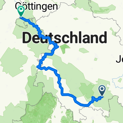
Werra-Radweg gesamt Neuhaus-Hann.Münden- Distance
- 325 km
- Ascent
- 160 m
- Descent
- 853 m
- Location
- Neuhaus am Rennweg, Thuringia, Germany
Rennsteig Radtour- Distance
- 86.2 km
- Ascent
- 632 m
- Descent
- 1,166 m
- Location
- Neuhaus am Rennweg, Thuringia, Germany
2023 Tag 7 Coburg- Distance
- 47 km
- Ascent
- 464 m
- Descent
- 893 m
- Location
- Neuhaus am Rennweg, Thuringia, Germany
Idyllisches Downhill- Distance
- 25.5 km
- Ascent
- 152 m
- Descent
- 593 m
- Location
- Neuhaus am Rennweg, Thuringia, Germany
Werratal-Radweg- Distance
- 327.1 km
- Ascent
- 2,312 m
- Descent
- 3,018 m
- Location
- Neuhaus am Rennweg, Thuringia, Germany
Werratal-Radweg- Distance
- 309 km
- Ascent
- 194 m
- Descent
- 897 m
- Location
- Neuhaus am Rennweg, Thuringia, Germany
Rennsteigstaffel 2010 Abschnitt 4,5,6- Distance
- 54.8 km
- Ascent
- 845 m
- Descent
- 831 m
- Location
- Neuhaus am Rennweg, Thuringia, Germany
RSSL_2012_4- Distance
- 17.6 km
- Ascent
- 311 m
- Descent
- 333 m
- Location
- Neuhaus am Rennweg, Thuringia, Germany
Open it in the app


