klaunzer_berg_89333908
A cycling route starting in Matrei in Osttirol, Tyrol, Austria.
Overview
About this route
- 12 h 7 min
- Duration
- 24.1 km
- Distance
- 1,271 m
- Ascent
- 1,269 m
- Descent
- 2 km/h
- Avg. speed
- 2,200 m
- Max. altitude
Continue with Bikemap
Use, edit, or download this cycling route
You would like to ride klaunzer_berg_89333908 or customize it for your own trip? Here is what you can do with this Bikemap route:
Free features
- Save this route as favorite or in collections
- Copy & plan your own version of this route
- Sync your route with Garmin or Wahoo
Premium features
Free trial for 3 days, or one-time payment. More about Bikemap Premium.
- Navigate this route on iOS & Android
- Export a GPX / KML file of this route
- Create your custom printout (try it for free)
- Download this route for offline navigation
Discover more Premium features.
Get Bikemap PremiumFrom our community
Other popular routes starting in Matrei in Osttirol
Matrei to Lienz- Distance
- 29 km
- Ascent
- 44 m
- Descent
- 341 m
- Location
- Matrei in Osttirol, Tyrol, Austria
Grossglocknerblick- Distance
- 12.2 km
- Ascent
- 363 m
- Descent
- 541 m
- Location
- Matrei in Osttirol, Tyrol, Austria
pragraten-johannishutte CLONED FROM ROUTE 614526- Distance
- 20.8 km
- Ascent
- 1,319 m
- Descent
- 166 m
- Location
- Matrei in Osttirol, Tyrol, Austria
Von Kals zur Lucknerhütte- Distance
- 9.4 km
- Ascent
- 953 m
- Descent
- 72 m
- Location
- Matrei in Osttirol, Tyrol, Austria
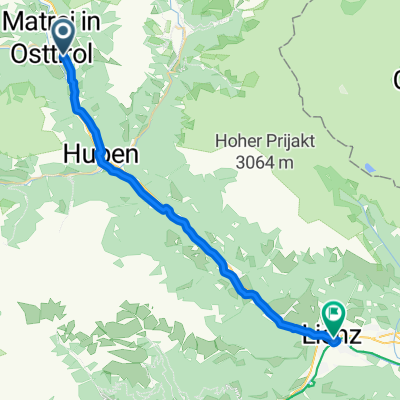
Europastraße, Matrei to Bozener Platz, Lienz- Distance
- 29.8 km
- Ascent
- 100 m
- Descent
- 353 m
- Location
- Matrei in Osttirol, Tyrol, Austria
zedl - zunig kurz u steil- Distance
- 8.1 km
- Ascent
- 908 m
- Descent
- 40 m
- Location
- Matrei in Osttirol, Tyrol, Austria
radweg_virgental_wasserfall- Distance
- 48.4 km
- Ascent
- 1,248 m
- Descent
- 1,247 m
- Location
- Matrei in Osttirol, Tyrol, Austria
kalser tauernhaus- Distance
- 18.3 km
- Ascent
- 436 m
- Descent
- 434 m
- Location
- Matrei in Osttirol, Tyrol, Austria
Open it in the app


