

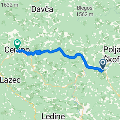
Poljane nad Škofjo Loko - Blegoš
A cycling route starting in Gorenja Vas, Občina Gorenja vas-Poljane, Slovenia.
Overview
About this route
- 4 h 34 min
- Duration
- 56.6 km
- Distance
- 2,645 m
- Ascent
- 2,662 m
- Descent
- 12.4 km/h
- Avg. speed
- 1,359 m
- Max. altitude

Route quality
Waytypes & surfaces along the route
Waytypes
Quiet road
32.8 km
(58 %)
Track
11.3 km
(20 %)
Surfaces
Paved
27.7 km
(49 %)
Unpaved
7.9 km
(14 %)
Asphalt
26.6 km
(47 %)
Gravel
5.7 km
(10 %)
Continue with Bikemap
Use, edit, or download this cycling route
You would like to ride Poljane nad Škofjo Loko - Blegoš or customize it for your own trip? Here is what you can do with this Bikemap route:
Free features
- Save this route as favorite or in collections
- Copy & plan your own version of this route
- Sync your route with Garmin or Wahoo
Premium features
Free trial for 3 days, or one-time payment. More about Bikemap Premium.
- Navigate this route on iOS & Android
- Export a GPX / KML file of this route
- Create your custom printout (try it for free)
- Download this route for offline navigation
Discover more Premium features.
Get Bikemap PremiumFrom our community
Other popular routes starting in Gorenja Vas
 gasper44 Planina-Črni vrh
- Distance
- 67.9 km
- Ascent
- 2,414 m
- Descent
- 2,413 m
- Location
- Gorenja Vas, Občina Gorenja vas-Poljane, Slovenia
 Cvetje v jeseni
- Distance
- 31.2 km
- Ascent
- 914 m
- Descent
- 908 m
- Location
- Gorenja Vas, Občina Gorenja vas-Poljane, Slovenia
 Todraž - Pasja Ravan
- Distance
- 11.6 km
- Ascent
- 683 m
- Descent
- 134 m
- Location
- Gorenja Vas, Občina Gorenja vas-Poljane, Slovenia
 Poljane nad Škofjo Loko - Blegoš
- Distance
- 56.6 km
- Ascent
- 2,645 m
- Descent
- 2,662 m
- Location
- Gorenja Vas, Občina Gorenja vas-Poljane, Slovenia
 gasper44 Ljubljana
- Distance
- 71.8 km
- Ascent
- 1,443 m
- Descent
- 1,440 m
- Location
- Gorenja Vas, Občina Gorenja vas-Poljane, Slovenia
 Gorenja Vas - Medvode
- Distance
- 18.3 km
- Ascent
- 691 m
- Descent
- 765 m
- Location
- Gorenja Vas, Občina Gorenja vas-Poljane, Slovenia
 Up to Kladje
- Distance
- 25.5 km
- Ascent
- 731 m
- Descent
- 721 m
- Location
- Gorenja Vas, Občina Gorenja vas-Poljane, Slovenia
 Poljane - Železniki - Podbrdo - Bača - Cerkno - Poljane
- Distance
- 124.5 km
- Ascent
- 2,961 m
- Descent
- 2,948 m
- Location
- Gorenja Vas, Občina Gorenja vas-Poljane, Slovenia
Open it in the app