

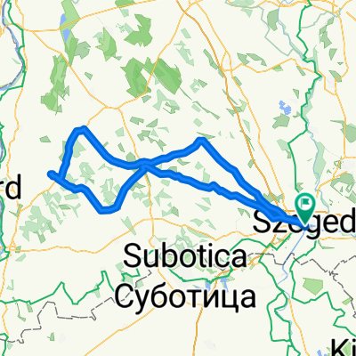
Mélypont kör
A cycling route starting in Szeged, Csongrád megye, Hungary.
Overview
About this route
- 1 h 51 min
- Duration
- 35.7 km
- Distance
- 109 m
- Ascent
- 115 m
- Descent
- 19.2 km/h
- Avg. speed
- 93 m
- Max. altitude

Route photos


Route quality
Waytypes & surfaces along the route
Waytypes
Cycleway
12.7 km
(36 %)
Quiet road
7.8 km
(22 %)
Surfaces
Paved
33.7 km
(94 %)
Unpaved
0.5 km
(1 %)
Asphalt
31.4 km
(88 %)
Paving stones
1.1 km
(3 %)
Continue with Bikemap
Use, edit, or download this cycling route
You would like to ride Mélypont kör or customize it for your own trip? Here is what you can do with this Bikemap route:
Free features
- Save this route as favorite or in collections
- Copy & plan your own version of this route
- Sync your route with Garmin or Wahoo
Premium features
Free trial for 3 days, or one-time payment. More about Bikemap Premium.
- Navigate this route on iOS & Android
- Export a GPX / KML file of this route
- Create your custom printout (try it for free)
- Download this route for offline navigation
Discover more Premium features.
Get Bikemap PremiumFrom our community
Other popular routes starting in Szeged
 Piknik a Mélyponton (75,8m tengerszint felett)
- Distance
- 23.8 km
- Ascent
- 25 m
- Descent
- 27 m
- Location
- Szeged, Csongrád megye, Hungary
 Maros menti nosztalgia, gyakran földúton...
- Distance
- 79.1 km
- Ascent
- 407 m
- Descent
- 446 m
- Location
- Szeged, Csongrád megye, Hungary
 Szeged - Töltésen Baks - Ópusztaszer - Szeged
- Distance
- 74.7 km
- Ascent
- 110 m
- Descent
- 103 m
- Location
- Szeged, Csongrád megye, Hungary
- Mélypont kör
- Distance
- 35.7 km
- Ascent
- 109 m
- Descent
- 115 m
- Location
- Szeged, Csongrád megye, Hungary
 Tisza Maraton útvonal terv 2011 Közép
- Distance
- 61.2 km
- Ascent
- 52 m
- Descent
- 51 m
- Location
- Szeged, Csongrád megye, Hungary
 80km szeged
- Distance
- 82.6 km
- Ascent
- 62 m
- Descent
- 64 m
- Location
- Szeged, Csongrád megye, Hungary
 szeged-hajós
- Distance
- 215 km
- Ascent
- 136 m
- Descent
- 137 m
- Location
- Szeged, Csongrád megye, Hungary
 Szeged, Bordány,Zákányszék, Mórahalom, Szeged
- Distance
- 55.2 km
- Ascent
- 34 m
- Descent
- 33 m
- Location
- Szeged, Csongrád megye, Hungary
Open it in the app